File:GulfofMexico3D.jpg

原本檔案 (3,000 × 2,451 像素,檔案大細:508 KB ,MIME類型:image/jpeg)
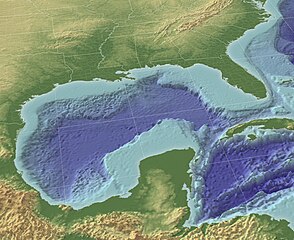
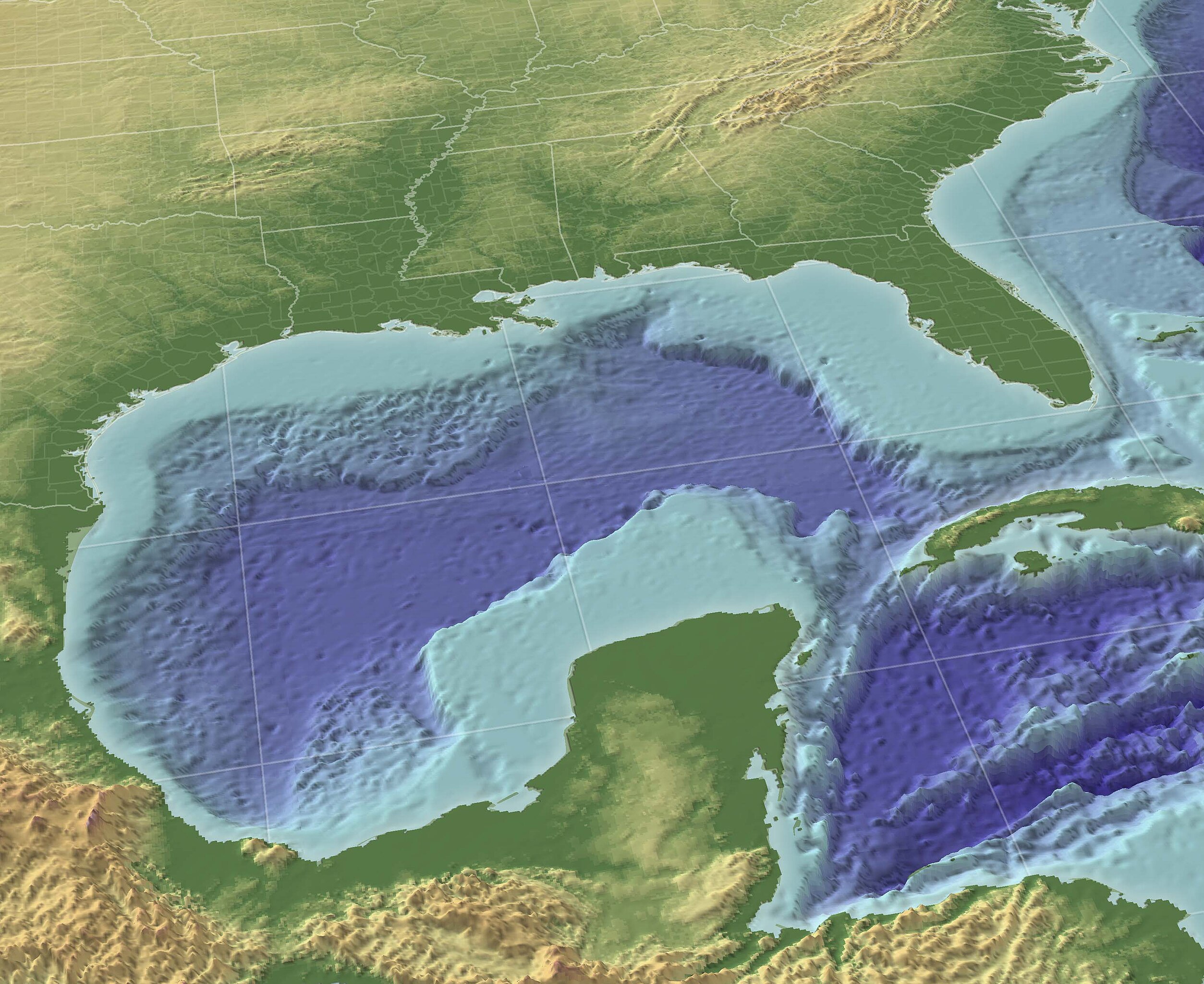
"The Gulf of Mexico in 3D perspective. A GIS can create very accurate and realistic-looking environments." Source (High-Res: 3000x2451).
This image is in the public domain because it contains materials that originally came from the U.S. National Oceanic and Atmospheric Administration, taken or made as part of an employee's official duties.
|
From English wikipedia w:en:Image:GulfofMexico3D.png
檔案歷史
撳個日期/時間去睇響嗰個時間出現過嘅檔案。
| 日期/時間 | 縮圖 | 尺寸 | 用戶 | 註解 | |
|---|---|---|---|---|---|
| 現時 | 2009年11月13號 (五) 10:30 | | 3,000 × 2,451(508 KB) | Justass | resolution |
| 2005年5月19號 (四) 18:36 |  | 1,024 × 837(545 KB) | Gengiskanhg | "The Gulf of Mexico in 3D perspective. A GIS can create very accurate and realistic-looking environments." [http://oceanexplorer.noaa.gov/technology/tools/mapping/media/GulfofMexico.jpg Source] (High-Res: 3000x2451). {{PD-USGov-NOAA}} From US wikipedia |
檔案用途
以下嘅1版用到呢個檔:
全域檔案使用情況
下面嘅維基都用緊呢個檔案:
- af.wikipedia.org嘅使用情況
- an.wikipedia.org嘅使用情況
- ar.wikipedia.org嘅使用情況
- ast.wikipedia.org嘅使用情況
- avk.wikipedia.org嘅使用情況
- azb.wikipedia.org嘅使用情況
- az.wikipedia.org嘅使用情況
- az.wiktionary.org嘅使用情況
- ba.wikipedia.org嘅使用情況
- be-tarask.wikipedia.org嘅使用情況
- be.wikipedia.org嘅使用情況
- br.wikipedia.org嘅使用情況
- bs.wikipedia.org嘅使用情況
- ca.wikipedia.org嘅使用情況
- ce.wikipedia.org嘅使用情況
- cs.wikipedia.org嘅使用情況
- cv.wikipedia.org嘅使用情況
- cy.wikipedia.org嘅使用情況
- da.wikipedia.org嘅使用情況
- de.wikipedia.org嘅使用情況
- en.wikipedia.org嘅使用情況
- en.wikibooks.org嘅使用情況
- en.wikinews.org嘅使用情況
- en.wiktionary.org嘅使用情況
- eo.wikipedia.org嘅使用情況
- es.wikipedia.org嘅使用情況
睇呢個檔案嘅更多全域使用情況。