File:Map of the Viceroyalty of New Spain.svg

呢個「SVG」檔案嘅呢個「PNG」預覽嘅大細:800 × 407 像素。 第啲解像度:320 × 163 像素|640 × 325 像素|1,024 × 520 像素|1,280 × 650 像素|2,560 × 1,301 像素|3,121 × 1,586 像素。
原本檔案 (SVG檔案,表面大細: 3,121 × 1,586 像素,檔案大細:1.67 MB)
摘要
| 描述 |
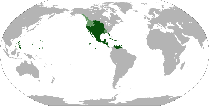
English: Anachronistic map of New Spain, built from Image:New_Spain.png by myself and released on multi-licence (GFDL and CC-BY 2.5). This image includes the territory of Louisiana, annexed to the Spanish Empire in 1763 after the Seven Years' War, but then given back to France in 1801. The areas in light green were territories claimed by Spain. |
| 日期 | |
| 來源 | |
| 作者 | Eddo |
協議
I, the copyright holder of this work, hereby publish it under the following licenses:
呢個檔案用共享創意 姓名標示-非商業性-相同方式分享3.0 未本地化版本條款授權。
- 你可以:
- 去分享 – 複製、發佈同傳播呢個作品
- 再改 – 創作演繹作品
- 要遵照下面嘅條件:
- 署名 – 你一定要畀合適嘅表彰、畀返指向呢個授權條款嘅連結,同埋寫明有無改過嚟。你可以用任何合理方式去做,但唔可以用任何方式暗示授權人認可咗你或者你嘅使用方式。
- 相同方式分享 – 如果你用任何方式改過呢個作品,你必須要用返原本或者相似嘅條款發佈。

|
根據自由軟體基金會發佈嘅無固定段落、封面文字同封底文字GNU自由文件授權條款第1.2或打後嘅版本,你獲授權可以重製、散佈同埋修改爾份文件。授權條款嘅副本喺章節GNU自由文件授權條款。 |
你可以揀你想用嘅牌照。
檔案歷史
撳個日期/時間去睇響嗰個時間出現過嘅檔案。
| 日期/時間 | 縮圖 | 尺寸 | 用戶 | 註解 | |
|---|---|---|---|---|---|
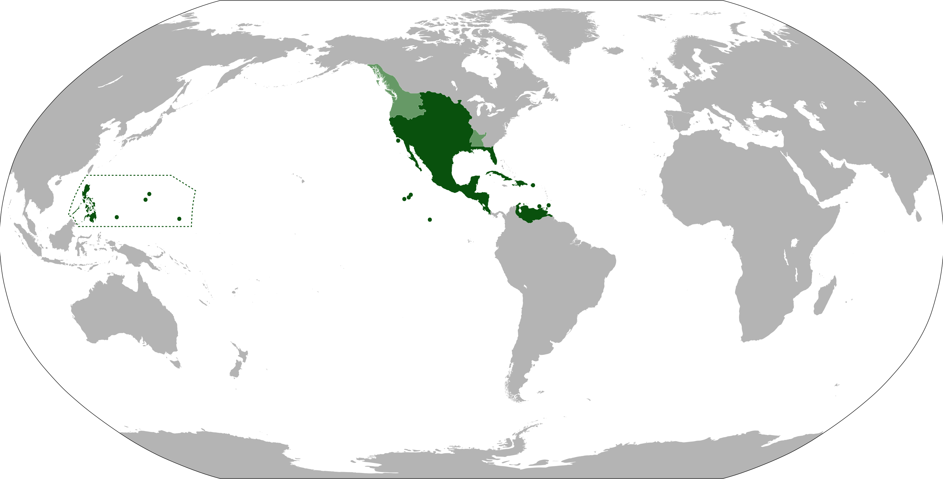
| 現時 | 2012年9月15號 (六) 11:09 | | 3,121 × 1,586(1.67 MB) | Milenioscuro | cambio la proyeccion, corrijo las fronteras de la Luisiana española, añado linderos de la capitanía general de las Filipinas |
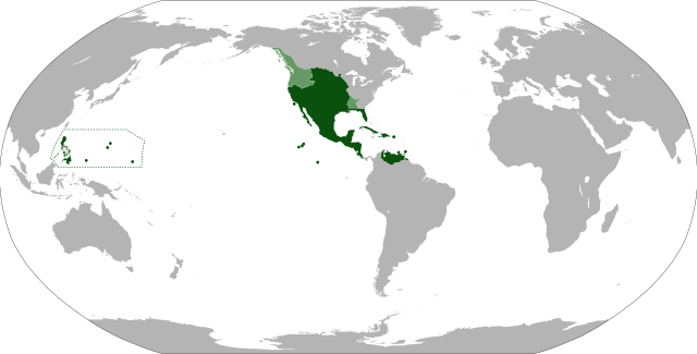
| 2012年8月6號 (一) 07:26 |  | 853 × 433(1.5 MB) | Unukalhai | La Capitanía General de Venezuela estuvo bajo jurisdicción de la Real Audiencia de Santo Domingo, y ésta a su vez, del Virreinato de Nueva España. | |
| 2011年6月13號 (一) 00:48 |  | 853 × 433(1.49 MB) | Durero | More islands: the Caroline, the Marianas, Palau... | |
| 2010年9月10號 (五) 07:21 |  | 853 × 433(1.49 MB) | Eddo | {{Information |Description={{en|1=Anachronistic map of New Spain, built from w:Image:New_Spain.png by myself and released on multi-licence (GFDL and CC-BY 2.5). This image includes the territory of Louisiana, annexed to the Spanish Empire in 1763 after th |
檔案用途
以下嘅1版用到呢個檔:
全域檔案使用情況
下面嘅維基都用緊呢個檔案:
- af.wikipedia.org嘅使用情況
- ar.wikipedia.org嘅使用情況
- ast.wikipedia.org嘅使用情況
- azb.wikipedia.org嘅使用情況
- ba.wikipedia.org嘅使用情況
- bg.wikipedia.org嘅使用情況
- br.wikipedia.org嘅使用情況
- ca.wikipedia.org嘅使用情況
- cs.wikipedia.org嘅使用情況
- da.wikipedia.org嘅使用情況
- de.wikipedia.org嘅使用情況
- el.wikipedia.org嘅使用情況
- en.wikipedia.org嘅使用情況
- eo.wikipedia.org嘅使用情況
- es.wikipedia.org嘅使用情況
- et.wikipedia.org嘅使用情況
- eu.wikipedia.org嘅使用情況
- fa.wikipedia.org嘅使用情況
- fi.wikipedia.org嘅使用情況
- fr.wikipedia.org嘅使用情況
- gl.wikipedia.org嘅使用情況
- he.wikipedia.org嘅使用情況
- hu.wikipedia.org嘅使用情況
- hy.wikipedia.org嘅使用情況
- ia.wikipedia.org嘅使用情況
- id.wikipedia.org嘅使用情況
- incubator.wikimedia.org嘅使用情況
- is.wikipedia.org嘅使用情況
睇呢個檔案嘅更多全域使用情況。