File:Middle East (orthographic projection).svg

呢個「SVG」檔案嘅呢個「PNG」預覽嘅大細:553 × 553 像素。 第啲解像度:240 × 240 像素|480 × 480 像素|768 × 768 像素|1,024 × 1,024 像素|2,048 × 2,048 像素。
原本檔案 (SVG檔案,表面大細: 553 × 553 像素,檔案大細:328 KB)
摘要
| 描述 | 中東 | ||||
| 日期 | |||||
| 來源 |
自己作品 (Original text: Own work,)
|
||||
| 作者 | TownDown | ||||
| Other versions |
.svg) |
||||
| SVG genesis |
.svg)
.svg)
.svg)
.svg)
.svg)
.svg)
.svg)
.svg)
.svg)
.svg)
.svg)
.svg)
.svg)
.svg)
.svg)
.svg)
.svg)
.svg)
.svg)
.svg)
.svg)
.svg)
.svg)
.svg)
.svg)
.svg)
.svg)
.svg)
.svg)
.svg)
.svg)
.svg)
.svg)
.svg)
.svg)
.svg)
.svg)
.svg)
.svg)
.svg)
.svg)
.svg)
.svg)
.svg)
.svg)
.svg)
.svg)
.svg)
.svg)
.svg)
.svg)
.svg)
.svg)
.svg)
.svg)
.svg)
.svg)
.svg)
.svg)
.svg)
.svg)
.svg)
.svg)
.svg)
.svg)
.svg)
.svg)
.svg)
.svg)
.svg)
.svg)
.svg)
.svg)

.svg)

.svg)

.svg)
.svg)
.svg)
.svg)
.svg)
.svg)
.svg)


.svg)
.svg)
.svg)
.svg)
.svg)
.svg)
.svg)

.svg)
.svg)
.svg)
.svg)
.svg)
.svg)
.svg)
.svg)
.svg)

.svg)
.svg)
.svg)
.svg)
.svg)
.svg)
.svg)
_without_national_boundaries.svg)
.svg)
.svg)
.svg)
.svg)
.svg)
.svg)

.svg)
.svg)
.png)
.svg)
.svg)
.svg)
.svg)

.svg)
.svg)
.svg)
.svg)
.svg)
.svg)
.svg)
.svg)
.svg)
.svg)
.svg)

.svg)
.svg)
.svg)
.svg)
.svg)
.svg)
.svg)
.svg)
.svg)

.svg)
.svg)

.svg)
.svg)
.svg)
.svg)
.svg)
.svg)
.svg)
.svg)
.svg)
.svg)
.svg)
.svg)
.svg)
.svg)
.svg)
.svg)
.svg)
.svg)
.svg)
.svg)
.svg)
.svg)
.svg)
.svg)
.svg)
.svg)
.svg)
_-_Crimea_disputed.svg)
.svg)
.svg)
.svg)
.svg)
.svg)
.svg)
.svg)
.svg)
.svg)
.svg)
.svg)
_political.svg)
.svg)
.svg)
.svg)
.svg)
_-_Crimea_disputed_-_no_borders.svg)
.svg)
.svg)
.svg)
.svg)
.svg)
.svg)
.svg)
.svg)
.svg)
.svg)
.svg)

.svg)
.svg)
.svg)

.png)
.svg)
.svg)
.svg)
.svg)
.svg)
.svg)
.svg)
.svg)
.svg)
.svg)
.svg)
.svg)
.svg)
.svg)
.svg)
.svg)
.svg)
.svg)
.svg)
.svg)
.svg)
.svg)
.svg)
.svg)
.svg)
.svg)
.svg)
.svg)
.svg)
.svg)
.svg)
.svg)
.svg)
.svg)
.png)
.svg)
.svg)
.svg)
_(orthographic_projection).png)
.svg?uselang=yue)
.svg)
.svg)
.svg)
.svg)
協議
我,呢份作品嘅作者,決定用以下許可發佈呢件作品:

|
根據自由軟體基金會發佈嘅無固定段落、封面文字同封底文字GNU自由文件授權條款第1.2或打後嘅版本,你獲授權可以重製、散佈同埋修改爾份文件。授權條款嘅副本喺章節GNU自由文件授權條款。 |
| 呢個檔案用共享創意 姓名標示-非商業性-相同方式分享3.0 未本地化版本條款授權。 | ||
| ||
| This licensing tag was added to this file as part of the GFDL licensing update. |
| Annotations | This image is annotated: View the annotations at Commons |
.svg)
檔案歷史
撳個日期/時間去睇響嗰個時間出現過嘅檔案。
.svg&dir=prev)
.svg&offset=20210329031415)
.svg&offset=&limit=20)
.svg&offset=&limit=50)
.svg&offset=&limit=100)
.svg&offset=&limit=250)
.svg&offset=&limit=500)
| 日期/時間 | 縮圖 | 尺寸 | 用戶 | 註解 | |
|---|---|---|---|---|---|
| 現時 | 2023年1月27號 (五) 03:10 | | 553 × 553(328 KB) | Treetoes023 | Reverted to version as of 15:50, 29 April 2021 (UTC): A map of the Middle East with all white borders will be made so this one can stay the same. |
| 2023年1月22號 (日) 17:17 |  | 553 × 553(328 KB) | M.Bitton | highlighted the inner borders, per request. Feel free to revert if you disagree | |
| 2021年4月29號 (四) 15:50 |  | 553 × 553(328 KB) | LightandDark2000 | Reverted to version as of 09:19, 6 April 2021 (UTC) Stop edit-warring. And your your're a [[:User:Mazum24}Mazum24]] sock, you're going to be Globally Locked. | |
| 2021年4月29號 (四) 15:28 |  | 553 × 553(406 KB) | Inkify | Reverted to version as of 07:56, 6 April 2021 (UTC) | |
| 2021年4月6號 (二) 09:19 |  | 553 × 553(328 KB) | Chipmunkdavis | Reverted to version as of 17:15, 17 March 2015 (UTC) Rv to stable image that has roughly been in place for a decade. New definition is far more restrictive than common usage. | |
| 2021年4月6號 (二) 07:56 |  | 553 × 553(406 KB) | GPinkerton | Reverted to version as of 16:16, 3 April 2021 (UTC) See talk page. There are already numerous maps of looser definitions these images should be used for those purposes. Wikipedia's (badly sourced, inaccurate) "Middle East" article should not govern the contents of this page. | |
| 2021年4月6號 (二) 07:41 |  | 553 × 553(328 KB) | Rsk6400 | Reverted to version as of 17:15, 17 March 2015 (UTC) - see COM:OW. Significantly changing this file causes problems, e.g. on en:Middle East | |
| 2021年4月3號 (六) 16:16 |  | 553 × 553(406 KB) | GPinkerton | Reverted to version as of 03:14, 29 March 2021 (UTC) reverting unexplained changes: see talk page | |
| 2021年4月1號 (四) 00:39 |  | 553 × 553(328 KB) | NotAMonarchist | Reverted to version as of 17:15, 17 March 2015 (UTC) | |
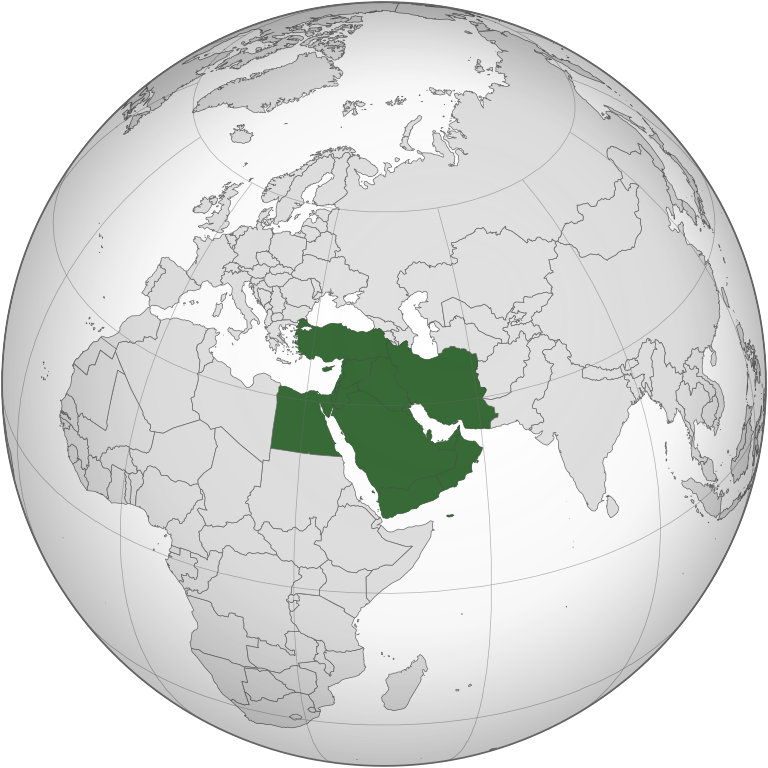
| 2021年3月29號 (一) 03:14 |  | 553 × 553(406 KB) | GPinkerton | Less expansive definition, according with the "generally accepted" definition mentioned by the ''Concise Oxford Dictionary of World Place Names'' (6th ed.): "comprising Iraq, Iran, Israel, Jordan, Lebanon, Syria, and the Arabian Peninsula". |
檔案用途
以下嘅1版用到呢個檔:
全域檔案使用情況
下面嘅維基都用緊呢個檔案:
- am.wikipedia.org嘅使用情況
- ar.wikipedia.org嘅使用情況
- الأردن
- لبنان
- سلطنة عمان
- اليمن
- العراق
- قطر
- إسرائيل
- الكويت
- قطاع غزة
- البحرين
- إيران
- قبرص
- تركيا
- قبرص الشمالية
- قالب:الشرق الأوسط
- إقليم كردستان العراق
- إمارة شرق الأردن
- دولة فلسطين
- بوابة:السعودية
- تاريخ الشرق الأوسط
- سوريا
- الشرق الأوسط الكبير
- بوابة:الكويت
- ويكيبيديا:صناديق المستخدم/بلدان
- مصر
- مطبخ الشرق الأوسط
- السعودية
- موسيقى الشرق الأوسط
- قرار مجلس الأمن التابع للأمم المتحدة رقم 425
- بوابة:القدس
- الشرق الأوسط
- الإمارات العربية المتحدة
- فلسطين
- بوابة:تركيا
- التعليم في قبرص الشمالية
- قرار مجلس الأمن التابع للأمم المتحدة رقم 369
- قرار مجلس الأمن التابع للأمم المتحدة رقم 368
- قرار مجلس الأمن التابع للأمم المتحدة رقم 378
- بوابة:البحرين
- بوابة:البحرين/قوالب
- قرار مجلس الأمن التابع للأمم المتحدة رقم 452
- قائمة نزاعات الشرق الأوسط الحديثة
- مستخدم:Avocato/مصر
- منظمة البورصة والأوراق المالية الإيرانية
- مستخدم:Abdullah Yamani/ملعب
- فيروس كورونا المرتبط بمتلازمة الشرق الأوسط التنفسية
- تصنيف:قادة دول الشرق الأوسط
- بوابة:الكويت/قوالب
- بوابة:السعودية/قوالب
睇呢個檔案嘅更多全域使用情況。
.svg)
.svg)