File:World map temperate.svg

呢個「SVG」檔案嘅呢個「PNG」預覽嘅大細:800 × 406 像素。 第啲解像度:320 × 162 像素|640 × 325 像素|1,024 × 520 像素|1,280 × 650 像素|2,560 × 1,299 像素|2,751 × 1,396 像素。
原本檔案 (SVG檔案,表面大細: 2,751 × 1,396 像素,檔案大細:2.28 MB)
摘要
| 描述 |
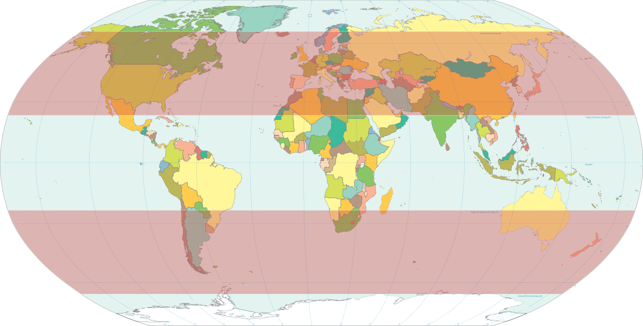
English: Classical temperate zones between 23½° and 66½° latitudes[1] highlighted on world map.
|
| 日期 | |
| 來源 | Own work based on: World map pol 2005 v02.svg |
| 作者 | HorsePunchKid |
| SVG genesis |
協議
This image is in the public domain because it contains materials that originally came from the United States Central Intelligence Agency's World Factbook.
|
 |
檔案歷史
撳個日期/時間去睇響嗰個時間出現過嘅檔案。
| 日期/時間 | 縮圖 | 尺寸 | 用戶 | 註解 | |
|---|---|---|---|---|---|
| 現時 | 2012年2月8號 (三) 20:16 | | 2,751 × 1,396(2.28 MB) | M0tty | update |
| 2007年2月13號 (二) 18:11 |  | 2,753 × 1,538(2.55 MB) | HorsePunchKid | World map with the temperate zones highlighted. Derived via Inkscape from Image:World map pol 2005 v02.svg, which is itself public domain. |
檔案用途
以下嘅1版用到呢個檔:
全域檔案使用情況
下面嘅維基都用緊呢個檔案:
- en.wikipedia.org嘅使用情況
- es.wikibooks.org嘅使用情況
- et.wikipedia.org嘅使用情況
- fa.wikipedia.org嘅使用情況
- fr.wikipedia.org嘅使用情況
- fr.wiktionary.org嘅使用情況
- ru.wikipedia.org嘅使用情況
- tr.wikipedia.org嘅使用情況