File:Banggai Islands Topography.png
原本檔案 (1,999 × 1,879 像素,檔案大細:1.25 MB ,MIME類型:image/png)
摘要
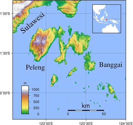
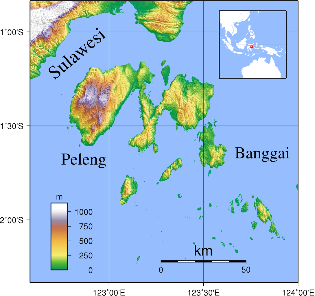
| 描述 | Topographic map of Banggai Islands, Indonesia. Created with GMT from SRTM data. The coastline data is pretty bad here, but since SRTM data of the region has a lot of spurious land masses, I had to use it nevertheless. |
| 日期 | |
| 來源 | 自己作品 |
| 作者 | Sadalmelik |
協議
I, the copyright holder of this work, hereby publish it under the following licenses:

|
根據自由軟體基金會發佈嘅無固定段落、封面文字同封底文字GNU自由文件授權條款第1.2或打後嘅版本,你獲授權可以重製、散佈同埋修改爾份文件。授權條款嘅副本喺章節GNU自由文件授權條款。 |
This file is licensed under the Creative Commons Attribution-Share Alike 3.0 Unported, 2.5 Generic, 2.0 Generic and 1.0 Generic license.
- 你可以:
- 去分享 – 複製、發佈同傳播呢個作品
- 再改 – 創作演繹作品
- 要遵照下面嘅條件:
- 署名 – 你一定要畀合適嘅表彰、畀返指向呢個授權條款嘅連結,同埋寫明有無改過嚟。你可以用任何合理方式去做,但唔可以用任何方式暗示授權人認可咗你或者你嘅使用方式。
- 相同方式分享 – 如果你用任何方式改過呢個作品,你必須要用返原本或者相似嘅條款發佈。
你可以揀你想用嘅牌照。
檔案歷史
撳個日期/時間去睇響嗰個時間出現過嘅檔案。
| 日期/時間 | 縮圖 | 尺寸 | 用戶 | 註解 | |
|---|---|---|---|---|---|
| 現時 | 2007年9月11號 (二) 21:17 |  | 1,999 × 1,879(1.25 MB) | Sadalmelik | {{Information |Description=Topographic map of Banggai Islands, Indonesia. Created with GMT from SRTM data. The coastline data is pretty bad here, but since SRTM data of the region has a lot of spurious land masses, I had to use it nevertheless. |Source=s |
檔案用途
全域檔案使用情況
下面嘅維基都用緊呢個檔案:
- ar.wikipedia.org嘅使用情況
- arz.wikipedia.org嘅使用情況
- ceb.wikipedia.org嘅使用情況
- de.wikipedia.org嘅使用情況
- en.wikipedia.org嘅使用情況
- es.wikipedia.org嘅使用情況
- eu.wikipedia.org嘅使用情況
- fi.wikipedia.org嘅使用情況
- fr.wikipedia.org嘅使用情況
- gl.wikipedia.org嘅使用情況
- id.wikipedia.org嘅使用情況
- it.wikipedia.org嘅使用情況
- ja.wikipedia.org嘅使用情況
- lt.wikipedia.org嘅使用情況
- lv.wikipedia.org嘅使用情況
- mrj.wikipedia.org嘅使用情況
- nl.wikipedia.org嘅使用情況
- pl.wikipedia.org嘅使用情況
- pt.wikipedia.org嘅使用情況
- ru.wikipedia.org嘅使用情況
- sv.wikipedia.org嘅使用情況
- ta.wikipedia.org嘅使用情況
- uk.wikipedia.org嘅使用情況
- vi.wikipedia.org嘅使用情況
- www.wikidata.org嘅使用情況
- wuu.wikipedia.org嘅使用情況
- zh.wikipedia.org嘅使用情況
睇呢個檔案嘅更多全域使用情況。