File:Chagos large.png
原本檔案 (1,311 × 1,947 像素,檔案大細:1.28 MB ,MIME類型:image/png)
摘要
| 描述 |
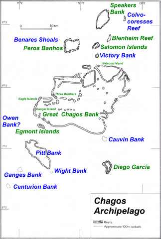
Deutsch: Karte des Chagos-Archipels im Indischen Ozean.
English: Map of Chagos-Archipelago in the Indian Ocean. |
| 日期 | not specified |
| 來源 | taken from http://www.coral.noaa.gov/Maps/chagos_large.jpg plus atoll and island names completed and rewritten |
| 作者 | NOAA, adapted by user Ratzer |
協議
This image is in the public domain because it contains materials that originally came from the U.S. National Oceanic and Atmospheric Administration, taken or made as part of an employee's official duties.
|
Original upload log
| date/time | username | Dimensions | File Size | edit summary |
|---|---|---|---|---|
| 11:01, 30 July 2006 | Ratzer | 1311×1947 | 1.28 MB | base map from http://www.coral.noaa.gov/reef_maps/volume2/chagos_large.jpg, plus atoll and island names completed and rewritten |
檔案歷史
撳個日期/時間去睇響嗰個時間出現過嘅檔案。
| 日期/時間 | 縮圖 | 尺寸 | 用戶 | 註解 | |
|---|---|---|---|---|---|
| 現時 | 2008年3月14號 (五) 08:43 | 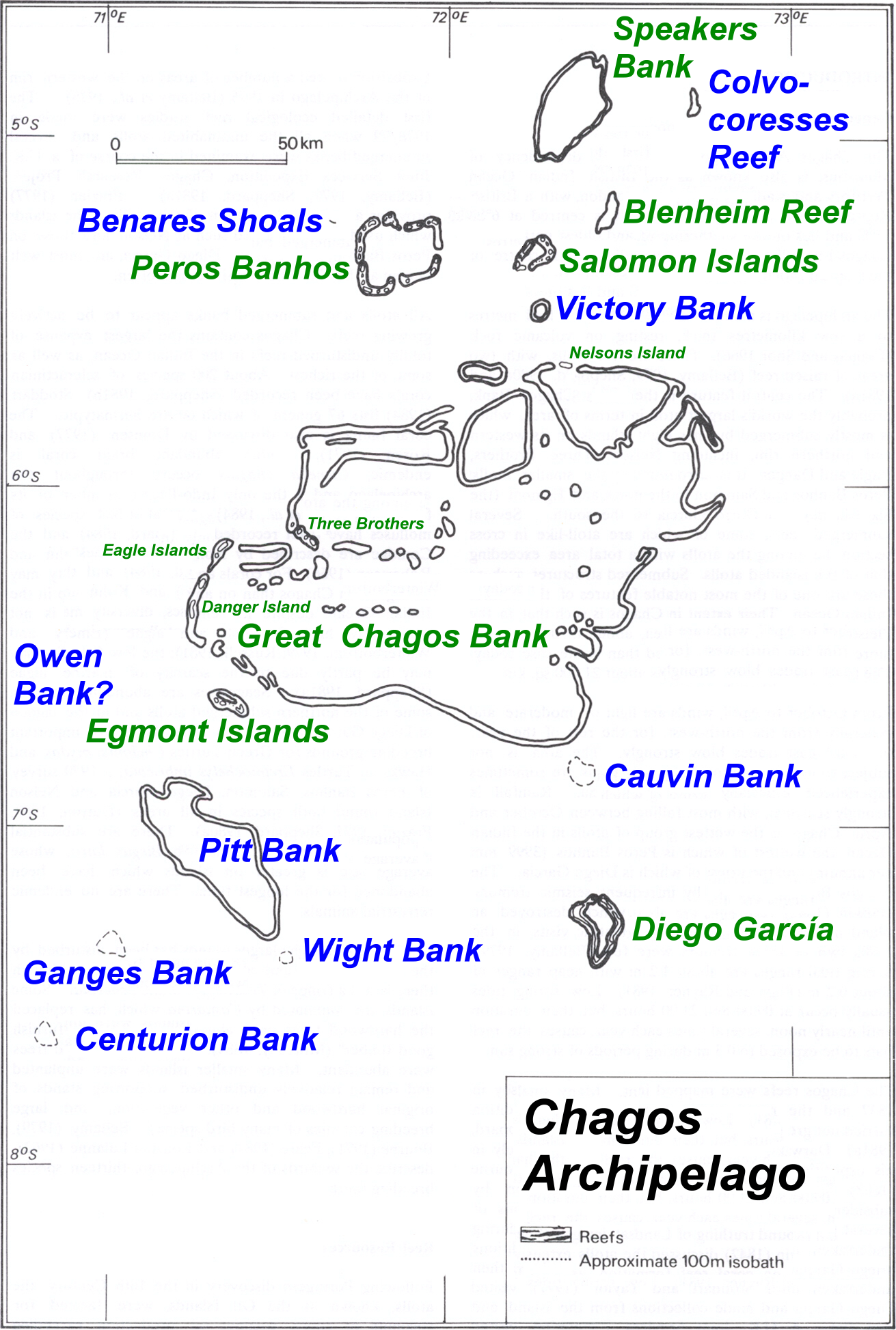 | 1,311 × 1,947(1.28 MB) | Telim tor | == Summary == {{Information |Description=Map of Chagos-Archipelago in the Indian Ocean. |Source=taken from http://www.coral.noaa.gov/reef_maps/volume2/chagos_large.jpg plus atoll and island names completed and rewritten |Date= |Author=NOAA |Permission= |o |
檔案用途
以下嘅1版用到呢個檔:
全域檔案使用情況
下面嘅維基都用緊呢個檔案:
- af.wikipedia.org嘅使用情況
- ar.wikipedia.org嘅使用情況
- ast.wikipedia.org嘅使用情況
- be-tarask.wikipedia.org嘅使用情況
- ceb.wikipedia.org嘅使用情況
- cs.wikipedia.org嘅使用情況
- da.wikipedia.org嘅使用情況
- de.wikipedia.org嘅使用情況
- en.wikipedia.org嘅使用情況
- eo.wikipedia.org嘅使用情況
- es.wikipedia.org嘅使用情況
- fa.wikipedia.org嘅使用情況
- fi.wikipedia.org嘅使用情況
- fr.wikipedia.org嘅使用情況
- gl.wikipedia.org嘅使用情況
- hr.wikipedia.org嘅使用情況
- io.wikipedia.org嘅使用情況
- ja.wikipedia.org嘅使用情況
- ka.wikipedia.org嘅使用情況
- lt.wikipedia.org嘅使用情況
- nl.wikipedia.org嘅使用情況
- ro.wikipedia.org嘅使用情況
- ru.wikipedia.org嘅使用情況
- ta.wikipedia.org嘅使用情況
- tr.wikipedia.org嘅使用情況
- uk.wikipedia.org嘅使用情況
睇呢個檔案嘅更多全域使用情況。