File:China Hong Kong location map.svg

呢個「SVG」檔案嘅呢個「PNG」預覽嘅大細:766 × 600 像素。 第啲解像度:307 × 240 像素|613 × 480 像素|981 × 768 像素|1,280 × 1,002 像素|2,560 × 2,004 像素|1,298 × 1,016 像素。
原本檔案 (SVG檔案,表面大細: 1,298 × 1,016 像素,檔案大細:244 KB)
摘要
| 描述 |
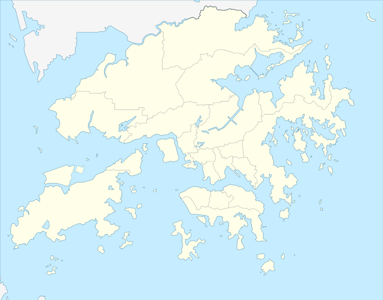
Deutsch: Postionskarte von Hong Kong
Quadratische Plattkarte. Geographische Begrenzung der Karte:
English: Location map of Hong Kong
Equirectangular projection. Geographic limits of the map:
|
||
| 日期 | |||
| 來源 | own work, using this file by Moddlyg | ||
| 作者 | Maximilian Dörrbecker (Chumwa) | ||
| 許可 (重用呢個檔案) |
I, the copyright holder of this work, hereby publish it under the following licenses:
呢個檔案用共享創意 姓名標示-非商業性-相同方式分享3.0 未本地化版本條款授權。
你可以揀你想用嘅牌照。 |


|
This map has been made or improved in the German Kartenwerkstatt (Map Lab). You can propose maps to improve as well.
|
檔案歷史
撳個日期/時間去睇響嗰個時間出現過嘅檔案。
| 日期/時間 | 縮圖 | 尺寸 | 用戶 | 註解 | |
|---|---|---|---|---|---|
| 現時 | 2024年4月13號 (六) 04:25 | | 1,298 × 1,016(244 KB) | TanoDano | Added HZMB HK Port Artificial Island |
| 2022年12月13號 (二) 23:56 |  | 1,298 × 1,016(245 KB) | Turbo Slayer 2021 | Reverted to version as of 02:34, 15 March 2022 (UTC) | |
| 2022年3月15號 (二) 02:35 |  | 1,298 × 1,016(244 KB) | Turbo Slayer 2021 | Reverted to version as of 15:10, 16 May 2021 (UTC) | |
| 2022年3月15號 (二) 02:34 |  | 1,298 × 1,016(245 KB) | Turbo Slayer 2021 | Reverted to version as of 07:02, 4 May 2021 (UTC) | |
| 2021年5月16號 (日) 15:10 |  | 1,298 × 1,016(244 KB) | 瑞丽江的河水 | Reverted to version as of 16:40, 12 September 2018 (UTC) | |
| 2021年5月4號 (二) 07:02 |  | 1,298 × 1,016(245 KB) | Turbo Slayer 2021 | Reverted to version as of 05:09, 29 March 2021 (UTC) | |
| 2021年3月29號 (一) 12:37 |  | 1,298 × 1,016(244 KB) | 瑞丽江的河水 | Reverted to version as of 16:40, 12 September 2018 (UTC), new coastline after the Hong Kong Zhuhai Macau Bridge Islands built, it is correct, please check with satellite imagery | |
| 2021年3月29號 (一) 05:09 |  | 1,298 × 1,016(245 KB) | Turbo Slayer 2021 | This is a actual map of Hong Kong due to the Hong Kong Zhuhai Macau Bridge Islands is not that size, Don't worry It will upload a new map until the third runway is finished, Please, wiki is a equal place that Mainland Chinese users are not allowed in this edit, because the firewall. if I found it, I will report to the wiki centre. Thank you. P.S. I am a Hong Konger | |
| 2021年3月28號 (日) 14:13 |  | 1,298 × 1,016(244 KB) | 瑞丽江的河水 | Reverted to version as of 16:40, 12 September 2018 (UTC) | |
| 2021年3月25號 (四) 12:56 |  | 1,298 × 1,016(245 KB) | Turbo Slayer 2021 | Reverted to version as of 09:39, 11 September 2011 (UTC) |
檔案用途
以下嘅89版用到呢個檔:
- 2019–20年香港超級聯賽
- 2020–21年香港超級聯賽
- 七二一元朗襲擊
- 中環
- 九逕山
- 九龍坑山
- 八仙嶺
- 北大刀岃
- 南朗山
- 吊手岩
- 大上托
- 大刀岃
- 大埔
- 大帽山
- 大東山
- 大老山
- 大金鐘
- 女婆山
- 婆髻山
- 孖崗山
- 寶雲山
- 小馬山
- 山地塘
- 平山
- 強烈熱帶風暴帕卡 (2017年)
- 彌勒山
- 慈雲山
- 手指山
- 打爛埕頂山
- 扯旗山
- 摩星嶺 (香港)
- 東洋山
- 柏架山
- 歌賦山
- 歌連臣山
- 水牛山
- 照鏡環山
- 熱帶風暴森拉克 (2020年)
- 牛押山
- 狗牙嶺
- 獅子山
- 玉桂山
- 班納山
- 田灣山
- 畢拿山
- 石屋山
- 石龍拱
- 窩仔山
- 筆架山
- 紅花嶺
- 紫羅蘭山
- 老虎頭
- 聶高信山
- 荃灣
- 草山
- 菱角山
- 薄刀屻
- 薑山
- 蚺蛇尖
- 西灣山
- 西灣山 (柴灣)
- 觀景山
- 象山 (九龍)
- 超強颱風天鴿
- 金馬倫山
- 針山
- 釣魚翁
- 雞胸山
- 雲枕山
- 青山 (杯渡)
- 青衣山
- 颱風海高斯 (2020年)
- 飛鵞山
- 香港兒童醫院
- 馬鞍山 (香港嘅山)
- 髻山
- 魔鬼山
- 鱷魚朝天
- 鳳凰山 (香港)
- 鴨仔山
- 鶴咀山
- 鷓鴣山
- 鷹巢山
- 黃嶺 (香港)
- 黃牛山
- 龍脊
- 龍虎山 (香港)
- Template:HKTY Wind
- Template:Location map Hong Kong
全域檔案使用情況
下面嘅維基都用緊呢個檔案:
- af.wikipedia.org嘅使用情況
- an.wikipedia.org嘅使用情況
- ar.wikipedia.org嘅使用情況
- ast.wikipedia.org嘅使用情況
- azb.wikipedia.org嘅使用情況
- az.wikipedia.org嘅使用情況
- ba.wikipedia.org嘅使用情況
- bcl.wikipedia.org嘅使用情況
- bg.wikipedia.org嘅使用情況
- bn.wikipedia.org嘅使用情況
- ceb.wikipedia.org嘅使用情況
睇呢個檔案嘅更多全域使用情況。