File:China edcp relief location map.jpg
原本檔案 (1,968 × 1,567 像素,檔案大細:562 KB ,MIME類型:image/jpeg)
摘要
| 描述 |
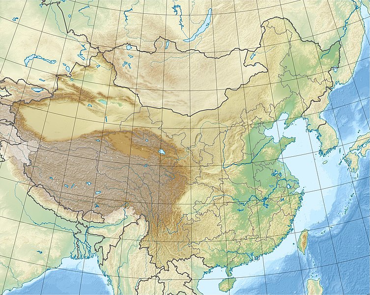
English: Location map of China.
EquiDistantConicProjection : Central parallel : * N: 36.0° N Central meridian : * E: 104.0° E Standard parallels : * 1: 30.0° N * 2: 42.0° N Latitudes on the central meridian : * top: 57.0° N * center: 37.29° N * bottom: 17.96° NMade with Natural Earth. Free vector and raster map data @ naturalearthdata.com. |
| 日期 | |
| 來源 | 自己作品 |
| 作者 | Uwe Dedering |
| Other versions |
|


Derivative works of this file: China edcp relief location map Sichuan.png
協議
I, the copyright holder of this work, hereby publish it under the following licenses:
呢個檔案用共享創意 姓名標示-非商業性-相同方式分享3.0 未本地化版本條款授權。
- 你可以:
- 去分享 – 複製、發佈同傳播呢個作品
- 再改 – 創作演繹作品
- 要遵照下面嘅條件:
- 署名 – 你一定要畀合適嘅表彰、畀返指向呢個授權條款嘅連結,同埋寫明有無改過嚟。你可以用任何合理方式去做,但唔可以用任何方式暗示授權人認可咗你或者你嘅使用方式。
- 相同方式分享 – 如果你用任何方式改過呢個作品,你必須要用返原本或者相似嘅條款發佈。

|
根據自由軟體基金會發佈嘅無固定段落、封面文字同封底文字GNU自由文件授權條款第1.2或打後嘅版本,你獲授權可以重製、散佈同埋修改爾份文件。授權條款嘅副本喺章節GNU自由文件授權條款。 |
你可以揀你想用嘅牌照。
檔案歷史
撳個日期/時間去睇響嗰個時間出現過嘅檔案。
| 日期/時間 | 縮圖 | 尺寸 | 用戶 | 註解 | |
|---|---|---|---|---|---|
| 現時 | 2010年3月3號 (三) 11:47 |  | 1,968 × 1,567(562 KB) | Uwe Dedering | {{Information |Description={{en|1=Location map of China. EquiDistantConicProjection. Center: * N: 36.0° N * E: 104.0° E Standard parallels: * 1: 30.0° E * 2: 42.0° E Made with Natural Earth. Free vector and raster map data @ naturalearthdata.com. |
檔案用途
全域檔案使用情況
下面嘅維基都用緊呢個檔案:
- ace.wikipedia.org嘅使用情況
- als.wikipedia.org嘅使用情況
- am.wikipedia.org嘅使用情況
- ar.wikipedia.org嘅使用情況
- arz.wikipedia.org嘅使用情況
- ast.wikipedia.org嘅使用情況
- az.wikipedia.org嘅使用情況
- Himalay
- Sarı dəniz
- Tyanşan
- Şensi zəlzələsi (1556)
- Everest
- Qansuda zəlzələ
- Panjin çimərliyi
- Şablon:Yer xəritəsi Çin
- Şərqi Çin dənizi
- Tanşan zəlzələsi (1976)
- Ludyan zəlzələsi (2014)
- Tayvan boğazı
- Haynan boğazı
- Qərbi Koreya körfəzi
- Leyçjoubandao yarımadası
- Üç dərə SES
- Haynan
- Kukunor
- Dumtinxu
- Xanka gölü
- Təkləməkan
- Qobi
- Qaşun Qobisi
- Cunqariya
- Tibet yaylası
- Jexe yaylası
- Böyük Ussurskiy
- Üç paralel çay
- Damansk adası
- Alaşan
- Hami səhrası
- Kubuqi
- Ordos
- Mu-Us
- Tenqer (səhra)
- Badın-Jaran
- Dzosotın-Elisun
- Çaydam
- Qanqdis
睇呢個檔案嘅更多全域使用情況。