File:Europe relief laea location map.jpg
原本檔案 (1,580 × 1,351 像素,檔案大細:1.1 MB ,MIME類型:image/jpeg)
India
摘要
| 描述 |
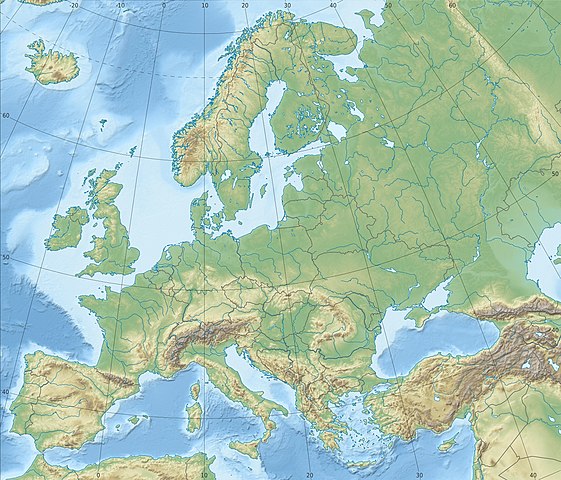
Deutsch: Physische Positionskarte Europa; Flächentreue Azimutalprojektion
English: Physical location map Europe; Lambert azimuthal equal-area projection
|
| 日期 | |
| 來源 |
自己作品
|
| 作者 | Alexrk2 |
| Other versions |
Derivative works of this file:
[]
|


.svg)


_ru.svg)

|
This map has been made or improved in the German Kartenwerkstatt (Map Lab). You can propose maps to improve as well.
|
協議
我,呢份作品嘅作者,決定用以下許可發佈呢件作品:
呢個檔案用共享創意 姓名標示-非商業性-相同方式分享3.0 未本地化版本條款授權。
- 你可以:
- 去分享 – 複製、發佈同傳播呢個作品
- 再改 – 創作演繹作品
- 要遵照下面嘅條件:
- 署名 – 你一定要畀合適嘅表彰、畀返指向呢個授權條款嘅連結,同埋寫明有無改過嚟。你可以用任何合理方式去做,但唔可以用任何方式暗示授權人認可咗你或者你嘅使用方式。
- 相同方式分享 – 如果你用任何方式改過呢個作品,你必須要用返原本或者相似嘅條款發佈。
檔案歷史
撳個日期/時間去睇響嗰個時間出現過嘅檔案。
| 日期/時間 | 縮圖 | 尺寸 | 用戶 | 註解 | |
|---|---|---|---|---|---|
| 現時 | 2018年7月4號 (三) 22:29 |  | 1,580 × 1,351(1.1 MB) | Subtropical-man | Reverted to version as of 22:56, 20 August 2012 (UTC) |
| 2018年7月2號 (一) 17:54 |  | 1,580 × 1,351(821 KB) | 1970gemini | fiat lux | |
| 2012年8月20號 (一) 22:56 |  | 1,580 × 1,351(1.1 MB) | McZusatz | Reverted to version as of 10:53, 14 March 2010 (...thumb fixed?) | |
| 2012年8月20號 (一) 22:55 |  | 120 × 103(4 KB) | McZusatz | fixing thumb... | |
| 2010年3月14號 (日) 10:53 |  | 1,580 × 1,351(1.1 MB) | Alexrk2 | == Summary == {{Information |Description= {{de|Physische Positionskarte Europa; Flächentreue Azimutalprojektion}} {{en|Physical location map Europe; Lambert azimuthal equal-area projection}} * Projection: LAEA Europe, [http: |
檔案用途
以下嘅1版用到呢個檔:
全域檔案使用情況
下面嘅維基都用緊呢個檔案:
- ab.wikipedia.org嘅使用情況
- als.wikipedia.org嘅使用情況
- ar.wikipedia.org嘅使用情況
- arz.wikipedia.org嘅使用情況
- ast.wikipedia.org嘅使用情況
- av.wikipedia.org嘅使用情況
- azb.wikipedia.org嘅使用情況
- az.wikipedia.org嘅使用情況
睇呢個檔案嘅更多全域使用情況。