File:JFK Airport - USGS 8 April 1994.jpg
原本檔案 (1,700 × 1,300 像素,檔案大細:435 KB ,MIME類型:image/jpeg)
摘要
| 描述 |
English: Aerial image of John F. Kennedy International Airport in Queens, New York, United States. |
| 日期 | |
| 來源 | USGS digital orthophoto via MSR Maps (formerly TerraServer-USA) |
| 作者 | United States Geological Survey (USGS) |
| 許可 (重用呢個檔案) |
Public domain |
| Object location | | View this and other nearby images on: OpenStreetMap |
|---|
協議
This image is in the public domain in the United States because it only contains materials that originally came from the United States Geological Survey, an agency of the United States Department of the Interior. For more information, see the official USGS copyright policy.
|
檔案歷史
撳個日期/時間去睇響嗰個時間出現過嘅檔案。
| 日期/時間 | 縮圖 | 尺寸 | 用戶 | 註解 | |
|---|---|---|---|---|---|
| 現時 | 2009年9月18號 (五) 14:01 | 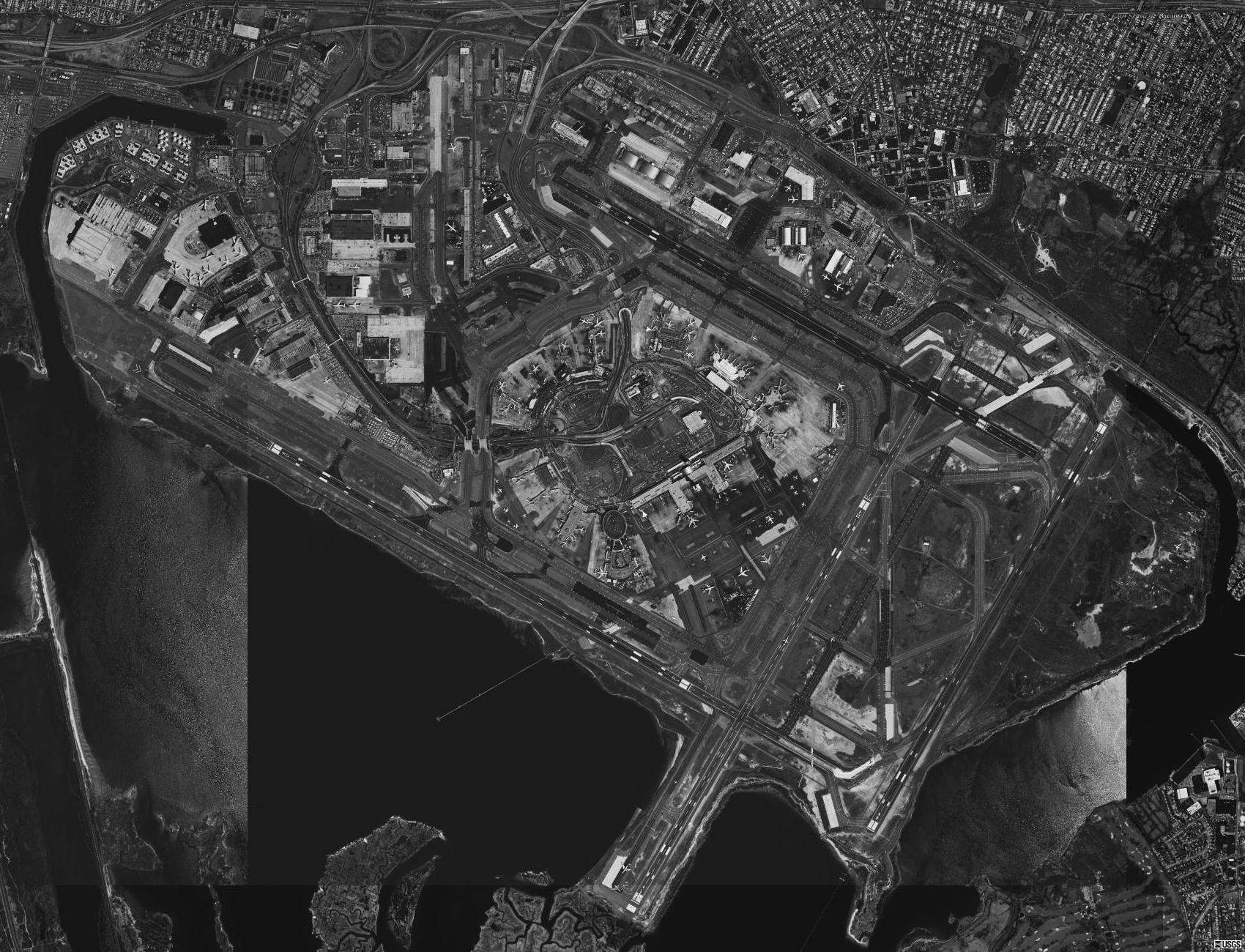 | 1,700 × 1,300(435 KB) | Zyxw | {{Information | description = {{en|Aerial image of {{w|John F. Kennedy International Airport}} in Queens, New York, United States.}} | date = 1994-04-08 | source = USGS digital {{w|orthophoto}} via [http://terraserver-usa.com/map.aspx?t=1&s=12&lon=-73.786 |
檔案用途
以下嘅1版用到呢個檔:
全域檔案使用情況
下面嘅維基都用緊呢個檔案:
- cy.wikipedia.org嘅使用情況
- en.wikinews.org嘅使用情況
- es.wikipedia.org嘅使用情況
- ru.wikipedia.org嘅使用情況