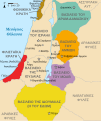
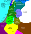
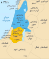
File:Kingdoms of Israel and Judah map 830.svg

呢個「SVG」檔案嘅呢個「PNG」預覽嘅大細:502 × 599 像素。 第啲解像度:201 × 240 像素|402 × 480 像素|644 × 768 像素|858 × 1,024 像素|1,717 × 2,048 像素|720 × 859 像素。
原本檔案 (SVG檔案,表面大細: 720 × 859 像素,檔案大細:96 KB)
檔案歷史
撳個日期/時間去睇響嗰個時間出現過嘅檔案。
| 日期/時間 | 縮圖 | 尺寸 | 用戶 | 註解 | |
|---|---|---|---|---|---|
| 現時 | 2021年10月1號 (五) 14:12 |  | 720 × 859(96 KB) | Sadopaul | File uploaded using svgtranslate tool (https://svgtranslate.toolforge.org/). Added translation for ko. |
| 2017年2月10號 (五) 15:50 |  | 720 × 859(80 KB) | Malus Catulus | removed 'Sizu' - a weird artifact from the Norse original | |
| 2011年2月12號 (六) 23:48 |  | 720 × 859(78 KB) | Malus Catulus | - | |
| 2010年7月13號 (二) 11:29 | 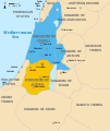 | 720 × 859(79 KB) | Malus Catulus | Fixed Judah color | |
| 2010年7月13號 (二) 10:51 |  | 720 × 859(79 KB) | Malus Catulus | Added colors for the two kingdoms and converted their text to path and arial | |
| 2010年7月12號 (一) 23:53 |  | 720 × 859(62 KB) | Malus Catulus | Shrinked down the borders | |
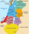
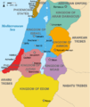
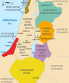
| 2010年7月12號 (一) 19:43 |  | 720 × 859(62 KB) | Malus Catulus | {{Information |Description={{en|1=Map showing the ancient levant borders and ancient cities such as Urmomium and Jerash. The map also shows the region in the 9th century BCE. Notice the coastal land of Philistia, from which the name "Palestine |
檔案用途
以下嘅2版用到呢個檔:
全域檔案使用情況
下面嘅維基都用緊呢個檔案:
- af.wikipedia.org嘅使用情況
- als.wikipedia.org嘅使用情況
- arz.wikipedia.org嘅使用情況
- azb.wikipedia.org嘅使用情況
- az.wikipedia.org嘅使用情況
- be-tarask.wikipedia.org嘅使用情況
- be.wikipedia.org嘅使用情況
- bg.wikipedia.org嘅使用情況
- bn.wikipedia.org嘅使用情況
- br.wikipedia.org嘅使用情況
- bs.wikipedia.org嘅使用情況
- bxr.wikipedia.org嘅使用情況
- ca.wikipedia.org嘅使用情況
- cdo.wikipedia.org嘅使用情況
- cs.wikipedia.org嘅使用情況
- da.wikipedia.org嘅使用情況
- de.wikipedia.org嘅使用情況
- de.wikibooks.org嘅使用情況
- en.wikipedia.org嘅使用情況
睇呢個檔案嘅更多全域使用情況。

