File:LocationSaintLucia.png
冇更高解像度嘅圖像。
LocationSaintLucia.png (250 × 115 像素,檔案大細:3 KB ,MIME類型:image/png)
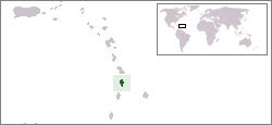
Location map for the Saint Lucia.
Originally created for English Wikipedia by Vardion.
| |
This work has been released into the public domain by its author, Vardion, at the 英文 維基百科 project. This applies worldwide. In case this is not legally possible: |

|
This locator map image could be recreated using vector graphics as an SVG file. This has several advantages; see Commons:Media for cleanup for more information. If an SVG form of this image is already available, please upload it. After uploading an SVG, replace this template with {{vector version available|new image name.svg}}.
|
檔案歷史
撳個日期/時間去睇響嗰個時間出現過嘅檔案。
| 日期/時間 | 縮圖 | 尺寸 | 用戶 | 註解 | |
|---|---|---|---|---|---|
| 現時 | 2008年1月16號 (三) 18:28 | | 250 × 115(3 KB) | Mahahahaneapneap | pngcrushed |
| 2004年12月20號 (一) 03:03 |  | 250 × 115(5 KB) | EugeneZelenko | Location map for the Saint Lucia.<br/>Originally created for English Wikipedia by Vardion.<br/>{{PD}}<br/>Category:Country locator maps |
檔案用途
以下嘅1版用到呢個檔:
全域檔案使用情況
下面嘅維基都用緊呢個檔案:
- ar.wikipedia.org嘅使用情況
- az.wiktionary.org嘅使用情況
- ba.wikipedia.org嘅使用情況
- be-tarask.wikipedia.org嘅使用情況
- be.wikipedia.org嘅使用情況
- bg.wikipedia.org嘅使用情況
- bn.wikipedia.org嘅使用情況
- bo.wikipedia.org嘅使用情況
- bpy.wikipedia.org嘅使用情況
- bs.wikipedia.org嘅使用情況
- ca.wikipedia.org嘅使用情況
- ceb.wikipedia.org嘅使用情況
- ckb.wikipedia.org嘅使用情況
- da.wikipedia.org嘅使用情況
- de.wikivoyage.org嘅使用情況
- de.wiktionary.org嘅使用情況
- el.wiktionary.org嘅使用情況
- en.wikipedia.org嘅使用情況
- en.wikivoyage.org嘅使用情況
- eo.wikipedia.org嘅使用情況
- es.wikipedia.org嘅使用情況
- es.wikinews.org嘅使用情況
- ext.wikipedia.org嘅使用情況
- fa.wikipedia.org嘅使用情況
- fiu-vro.wikipedia.org嘅使用情況
- fo.wikipedia.org嘅使用情況
- frp.wikipedia.org嘅使用情況
- fr.wikipedia.org嘅使用情況
- fy.wikipedia.org嘅使用情況
- gv.wikipedia.org嘅使用情況
- he.wikivoyage.org嘅使用情況
- hif.wikipedia.org嘅使用情況
- hr.wikipedia.org嘅使用情況
- ht.wikipedia.org嘅使用情況
- hu.wikipedia.org嘅使用情況
睇呢個檔案嘅更多全域使用情況。