File:Location Malay Archipelago.png
冇更高解像度嘅圖像。
Location_Malay_Archipelago.png (640 × 326 像素,檔案大細:17 KB ,MIME類型:image/png)
摘要
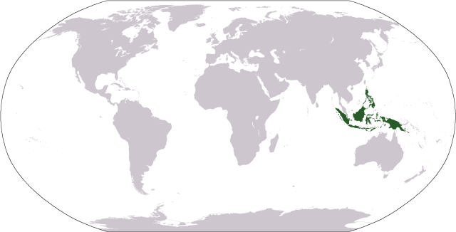
| 描述 |
World map depicting the Malay Archipelago; includes islands per en:Oxford English Dictionary and Encyclopaedia Britannica Map adapted from PDF world map at en:CIA World Fact Book |
| 日期 | 2006年9月18號 (original upload date) |
| 來源 | Galelio |
| 作者 | Galelio |
協議
| I, the copyright holder of this work, release this work into the public domain. This applies worldwide. In some countries this may not be legally possible; if so: I grant anyone the right to use this work for any purpose, without any conditions, unless such conditions are required by law. |
檔案歷史
撳個日期/時間去睇響嗰個時間出現過嘅檔案。
| 日期/時間 | 縮圖 | 尺寸 | 用戶 | 註解 | |
|---|---|---|---|---|---|
| 現時 | 2006年9月18號 (一) 02:48 | | 640 × 326(17 KB) | Cogito ergo sumo~commonswiki | World map: Malay Archipelago (location) |
檔案用途
以下嘅1版用到呢個檔:
全域檔案使用情況
下面嘅維基都用緊呢個檔案:
- ace.wikipedia.org嘅使用情況
- af.wikipedia.org嘅使用情況
- bcl.wikipedia.org嘅使用情況
- bg.wikipedia.org嘅使用情況
- bn.wikipedia.org嘅使用情況
- bs.wikipedia.org嘅使用情況
- cs.wikipedia.org嘅使用情況
- cy.wikipedia.org嘅使用情況
- en.wikipedia.org嘅使用情況
- en.wikivoyage.org嘅使用情況
- eo.wikipedia.org嘅使用情況
- et.wikipedia.org嘅使用情況
- fa.wikipedia.org嘅使用情況
- fi.wikipedia.org嘅使用情況
- hr.wikipedia.org嘅使用情況
- is.wikipedia.org嘅使用情況
- it.wikipedia.org嘅使用情況
- ja.wikipedia.org嘅使用情況
- ka.wikipedia.org嘅使用情況
- km.wikipedia.org嘅使用情況
- ko.wikipedia.org嘅使用情況
- ku.wikipedia.org嘅使用情況
- lt.wikipedia.org嘅使用情況
- mg.wikipedia.org嘅使用情況
- mk.wikipedia.org嘅使用情況
- mr.wikipedia.org嘅使用情況
- ms.wikipedia.org嘅使用情況
- pl.wikipedia.org嘅使用情況
- pt.wikipedia.org嘅使用情況
- sh.wikipedia.org嘅使用情況
- simple.wikipedia.org嘅使用情況
- sk.wikipedia.org嘅使用情況
- sl.wikipedia.org嘅使用情況
- sr.wikipedia.org嘅使用情況
- stq.wikipedia.org嘅使用情況
- sw.wikipedia.org嘅使用情況
- ta.wikipedia.org嘅使用情況
- th.wikipedia.org嘅使用情況
- tl.wikipedia.org嘅使用情況
- uz.wikipedia.org嘅使用情況
- war.wikipedia.org嘅使用情況