File:Map of federal subjects of Russia (2014).svg

呢個「SVG」檔案嘅呢個「PNG」預覽嘅大細:800 × 440 像素。 第啲解像度:320 × 176 像素|640 × 352 像素|1,024 × 563 像素|1,280 × 704 像素|2,560 × 1,409 像素|5,029 × 2,767 像素。
原本檔案 (SVG檔案,表面大細: 5,029 × 2,767 像素,檔案大細:711 KB)
.svg?uselang=yue)

|
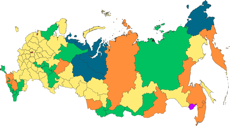
The boundaries on this map show the de facto situation. This is just one of several different views on the subject (see COM:NPOV). |
摘要
| 描述 |
Русский: Федеративное устройство Российской Федерации с 18 марта 2014 года |
| 日期 | |
| 來源 | 自己作品 |
| 作者 | Roman Poulvas |
| Other versions | File:Map of federal subjects of Russia 2014, disputed Crimea.svg |
協議
我,呢份作品嘅作者,決定用以下許可發佈呢件作品:
This file is licensed under the Creative Commons Attribution-Share Alike 4.0 International license.
- 你可以:
- 去分享 – 複製、發佈同傳播呢個作品
- 再改 – 創作演繹作品
- 要遵照下面嘅條件:
- 署名 – 你一定要畀合適嘅表彰、畀返指向呢個授權條款嘅連結,同埋寫明有無改過嚟。你可以用任何合理方式去做,但唔可以用任何方式暗示授權人認可咗你或者你嘅使用方式。
- 相同方式分享 – 如果你用任何方式改過呢個作品,你必須要用返原本或者相似嘅條款發佈。
| Annotations | This image is annotated: View the annotations at Commons |
.svg)
檔案歷史
撳個日期/時間去睇響嗰個時間出現過嘅檔案。
| 日期/時間 | 縮圖 | 尺寸 | 用戶 | 註解 | |
|---|---|---|---|---|---|
| 現時 | 2022年3月5號 (六) 13:58 | | 5,029 × 2,767(711 KB) | Foghe | The law of the Federation does not account for "occupied peninsula". |
| 2022年3月2號 (三) 18:43 |  | 512 × 282(723 KB) | Mzajac | Hatching for occupied Crimean peninsula | |
| 2022年3月2號 (三) 02:20 |  | 5,029 × 2,767(711 KB) | Spesh531 | Removing duplicate objects, and fixing minor mistake. Bolshoy Begichev Island was shown as part of Krasnoyarsk Krai instead of Sakha Republic. | |
| 2020年1月27號 (一) 17:44 |  | 512 × 282(512 KB) | Takhirgeran Umar | уточнение | |
| 2019年3月9號 (六) 10:47 |  | 512 × 282(499 KB) | AndreyKva | Optimized. | |
| 2018年10月30號 (二) 17:16 |  | 512 × 282(2.4 MB) | Roman Poulvas | По данным из шейп-файлов с нормальной проекцией: Projection: Lambert_Azimuthal_Equal_Area False_Easting: 0,0 False_Northing: 0,0 Central_Meridian: 100,0 Latitude_Of_Origin: 54,0 Linear Unit: Meter (1,0) | |
| 2016年12月13號 (二) 10:35 |  | 1,608 × 936(129 KB) | Roman Poulvas | Уточнены границы, добавлены примечания | |
| 2015年5月5號 (二) 13:41 |  | 1,025 × 600(163 KB) | Roman Poulvas | Исправлены Коми и Удмуртия | |
| 2015年5月4號 (一) 15:35 |  | 1,025 × 600(163 KB) | Roman Poulvas | User created page with UploadWizard |
檔案用途
以下嘅1版用到呢個檔:
全域檔案使用情況
下面嘅維基都用緊呢個檔案:
- alt.wikipedia.org嘅使用情況
- ami.wikipedia.org嘅使用情況
- arz.wikipedia.org嘅使用情況
- av.wikipedia.org嘅使用情況
- azb.wikipedia.org嘅使用情況
- az.wikipedia.org嘅使用情況
- be-tarask.wikipedia.org嘅使用情況
- bs.wikipedia.org嘅使用情況
- ce.wikipedia.org嘅使用情況
- cs.wikipedia.org嘅使用情況
- cv.wikipedia.org嘅使用情況
- cy.wikipedia.org嘅使用情況
- da.wikipedia.org嘅使用情況
- en.wikipedia.org嘅使用情況
- fi.wikipedia.org嘅使用情況
- fr.wikipedia.org嘅使用情況
- ha.wikipedia.org嘅使用情況
- hu.wikipedia.org嘅使用情況
- inh.wikipedia.org嘅使用情況
- km.wikipedia.org嘅使用情況
- ko.wikipedia.org嘅使用情況
- lld.wikipedia.org嘅使用情況
- mhr.wikipedia.org嘅使用情況
- mk.wikipedia.org嘅使用情況
- mnw.wikipedia.org嘅使用情況
- ms.wikipedia.org嘅使用情況
- myv.wikipedia.org嘅使用情況
- pl.wikipedia.org嘅使用情況
- ro.wikipedia.org嘅使用情況
- ru.wikipedia.org嘅使用情況
- sd.wikipedia.org嘅使用情況
- simple.wikipedia.org嘅使用情況
- sl.wikipedia.org嘅使用情況
- sq.wikipedia.org嘅使用情況
- sr.wikipedia.org嘅使用情況
睇呢個檔案嘅更多全域使用情況。
.svg)
.svg)