File:Mt. Iwate and Morioka.jpg
原本檔案 (2,560 × 1,920 像素,檔案大細:1.93 MB ,MIME類型:image/jpeg)
摘要
| 描述 | |
| 日期 | |
| 來源 | https://www.flickr.com/photos/21112151@N00/288967202/ |
| 作者 | yisris from Morioka, Japan |
| Camera location | | View this and other nearby images on: OpenStreetMap |
|---|
協議
This file is licensed under the Creative Commons Attribution-Share Alike 2.0 Generic license.
姓名標示: yisris
- 你可以:
- 去分享 – 複製、發佈同傳播呢個作品
- 再改 – 創作演繹作品
- 要遵照下面嘅條件:
- 署名 – 你一定要畀合適嘅表彰、畀返指向呢個授權條款嘅連結,同埋寫明有無改過嚟。你可以用任何合理方式去做,但唔可以用任何方式暗示授權人認可咗你或者你嘅使用方式。
- 相同方式分享 – 如果你用任何方式改過呢個作品,你必須要用返原本或者相似嘅條款發佈。
| This image was originally posted to Flickr by yisris at https://www.flickr.com/photos/21112151@N00/288967202. It was reviewed on 2009年7月1號 by FlickreviewR and was confirmed to be licensed under the terms of the cc-by-sa-2.0. |
檔案歷史
撳個日期/時間去睇響嗰個時間出現過嘅檔案。
| 日期/時間 | 縮圖 | 尺寸 | 用戶 | 註解 | |
|---|---|---|---|---|---|
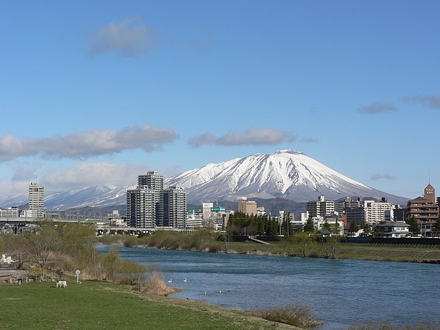
| 現時 | 2009年7月1號 (三) 14:48 |  | 2,560 × 1,920(1.93 MB) | トトト | {{Information |Description={{ja|岩手山と盛岡市。}}{{en|Mt. Iwate and Morioka City.}} |Source=[http://www.flickr.com/photos/21112151@N00/288967202/ Mt. Iwate and Morioka] |Date=2006-04-21 2 |
檔案用途
以下嘅1版用到呢個檔:
全域檔案使用情況
下面嘅維基都用緊呢個檔案:
- arz.wikipedia.org嘅使用情況
- azb.wikipedia.org嘅使用情況
- ceb.wikipedia.org嘅使用情況
- ce.wikipedia.org嘅使用情況
- da.wikipedia.org嘅使用情況
- de.wikipedia.org嘅使用情況
- en.wikipedia.org嘅使用情況
- es.wikipedia.org嘅使用情況
- es.wikivoyage.org嘅使用情況
- eu.wikipedia.org嘅使用情況
- fa.wikipedia.org嘅使用情況
- fi.wikipedia.org嘅使用情況
- fr.wikipedia.org嘅使用情況
- fr.wikivoyage.org嘅使用情況
- he.wikipedia.org嘅使用情況
- hu.wikipedia.org嘅使用情況
- id.wikipedia.org嘅使用情況
- incubator.wikimedia.org嘅使用情況
- it.wikipedia.org嘅使用情況
- ja.wikipedia.org嘅使用情況
睇呢個檔案嘅更多全域使用情況。