File:Rio Negro sunset.jpg

原本檔案 (3,901 × 2,926 像素,檔案大細:2.86 MB ,MIME類型:image/jpeg)
摘要
| Camera location | | View this and other nearby images on: OpenStreetMap |
|---|
| 描述 |
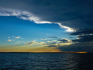
English: The sun sets behind some clouds on the Rio Negro river, near Manaus in Brazil. |
| 日期 | |
| 來源 | 自己作品 |
| 作者 | Eiwe Lingefors |
協議
我,呢份作品嘅作者,決定用以下許可發佈呢件作品:
呢個檔案用共享創意 姓名標示-非商業性-相同方式分享3.0 未本地化版本條款授權。
- 你可以:
- 去分享 – 複製、發佈同傳播呢個作品
- 再改 – 創作演繹作品
- 要遵照下面嘅條件:
- 署名 – 你一定要畀合適嘅表彰、畀返指向呢個授權條款嘅連結,同埋寫明有無改過嚟。你可以用任何合理方式去做,但唔可以用任何方式暗示授權人認可咗你或者你嘅使用方式。
- 相同方式分享 – 如果你用任何方式改過呢個作品,你必須要用返原本或者相似嘅條款發佈。
檔案歷史
撳個日期/時間去睇響嗰個時間出現過嘅檔案。
| 日期/時間 | 縮圖 | 尺寸 | 用戶 | 註解 | |
|---|---|---|---|---|---|
| 現時 | 2012年6月15號 (五) 21:20 | | 3,901 × 2,926(2.86 MB) | Elingefors |
檔案用途
以下嘅1版用到呢個檔:
全域檔案使用情況
下面嘅維基都用緊呢個檔案:
- af.wikipedia.org嘅使用情況
- azb.wikipedia.org嘅使用情況
- az.wikipedia.org嘅使用情況
- bh.wikipedia.org嘅使用情況
- bs.wikipedia.org嘅使用情況
- cs.wikipedia.org嘅使用情況
- es.wikipedia.org嘅使用情況
- fr.wikipedia.org嘅使用情況
- hr.wikipedia.org嘅使用情況
- ko.wikipedia.org嘅使用情況
- la.wikipedia.org嘅使用情況
- lv.wikipedia.org嘅使用情況
- pa.wikipedia.org嘅使用情況
- sco.wikipedia.org嘅使用情況
- th.wikipedia.org嘅使用情況
- war.wikipedia.org嘅使用情況