File:Socotra satview.jpg
預覽大細:800 × 593 像素。 第啲解像度:320 × 237 像素|640 × 474 像素|1,024 × 758 像素|1,280 × 948 像素。
原本檔案 (1,280 × 948 像素,檔案大細:159 KB ,MIME類型:image/jpeg)
摘要
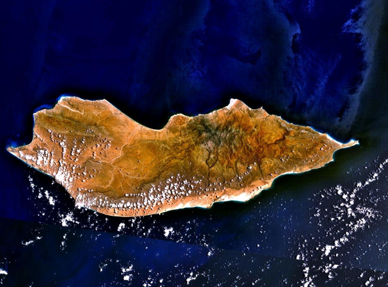
Satellite image over Socotra Island (سُقُطْرَى ; Suquṭra), made using NASA World Wind using Landsat imagery.
協議
| This image is in the public domain because it is a screenshot from NASA’s globe software World Wind using a public domain layer, such as Blue Marble, MODIS, Landsat, SRTM, USGS or GLOBE.
|
 |
Original upload log
All following user names refer to en.wikipedia.
- 2005-07-15 18:16 Finlay McWalter 1280×948×8 (163257 bytes) Satellite image of [[Socotra]], made using [[NASA World Wind]] using [[Landsat]] imagery. {{PD-USGov-NASA}}
| Annotations | This image is annotated: View the annotations at Commons |
檔案歷史
撳個日期/時間去睇響嗰個時間出現過嘅檔案。
| 日期/時間 | 縮圖 | 尺寸 | 用戶 | 註解 | |
|---|---|---|---|---|---|
| 現時 | 2007年1月7號 (日) 16:16 | | 1,280 × 948(159 KB) | EskoG-67 | {{Information |Description= Satellite image over Socotra island |Source=NASA Landsat |Date= 7.1.2007 |Author= |Permission= |other_versions= }} |
檔案用途
以下嘅1版用到呢個檔:
全域檔案使用情況
下面嘅維基都用緊呢個檔案:
- af.wikipedia.org嘅使用情況
- ar.wikipedia.org嘅使用情況
- ast.wikipedia.org嘅使用情況
- az.wikipedia.org嘅使用情況
- be-tarask.wikipedia.org嘅使用情況
- be.wikipedia.org嘅使用情況
- bg.wikipedia.org嘅使用情況
- bn.wikipedia.org嘅使用情況
- ca.wikipedia.org嘅使用情況
- cs.wikipedia.org嘅使用情況
- cv.wikipedia.org嘅使用情況
- cy.wikipedia.org嘅使用情況
- da.wikipedia.org嘅使用情況
- de.wikipedia.org嘅使用情況
- diq.wikipedia.org嘅使用情況
- el.wikipedia.org嘅使用情況
- en.wikipedia.org嘅使用情況
- eo.wikipedia.org嘅使用情況
- es.wikipedia.org嘅使用情況
- et.wikipedia.org嘅使用情況
- eu.wikipedia.org嘅使用情況
- fa.wikipedia.org嘅使用情況
- fi.wikipedia.org嘅使用情況
- fr.wikipedia.org嘅使用情況
睇呢個檔案嘅更多全域使用情況。