File:Tottenham, The Broadwater Farm Estate, N17 - geograph.org.uk - 235156.jpg
冇更高解像度嘅圖像。
Tottenham,_The_Broadwater_Farm_Estate,_N17_-_geograph.org.uk_-_235156.jpg (640 × 480 像素,檔案大細:89 KB ,MIME類型:image/jpeg)
摘要
| 描述 |
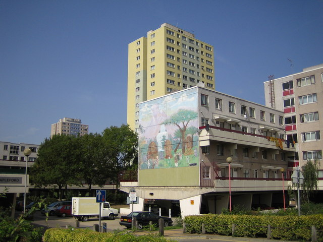
English: Tottenham: The Broadwater Farm Estate, N17. The estate was built between 1967 and 1973 in a style designed by Le Corbusier where no dwellings were at ground level because of the high water table of the Moselle River which is culverted under the estate. The warren of first floor concrete walkways offered opportunities for crime and anti-social behaviour and the consequent bad reputation of the estate long before the riot of 6 October 1985 which resulted in the murder of PC Keith Blakelock. Further information on the history of the estate can be found on Haringey Council's website here http://www.haringey.gov.uk/index/community_and_leisure/neighbourhoods/broadwaterfarm/historyofbroadwaterfarm.htm The mural is on the end wall of Rochford block and features Martin Luther King, Bob Marley, Mahatma Gandhi, and John Lennon. See 235530 for another photo of the estate in an adjacent grid square. |
| 日期 | |
| 來源 | From geograph.org.uk |
| 作者 | Nigel Cox |
| 姓名標示 (required by the license) | Nigel Cox / Tottenham: The Broadwater Farm Estate, N17 / |
| Camera location | | View this and other nearby images on: OpenStreetMap |
|---|
_heading:315.00&language=yue)
| Object location | | View this and other nearby images on: OpenStreetMap |
|---|
_heading:315.00&language=yue)
協議

|
This image was taken from the Geograph project collection. See this photograph's page on the Geograph website for the photographer's contact details. The copyright on this image is owned by Nigel Cox and is licensed for reuse under the Creative Commons Attribution-ShareAlike 2.0 license.
|
This file is licensed under the Creative Commons Attribution-Share Alike 2.0 Generic license.
姓名標示: Nigel Cox
- 你可以:
- 去分享 – 複製、發佈同傳播呢個作品
- 再改 – 創作演繹作品
- 要遵照下面嘅條件:
- 署名 – 你一定要畀合適嘅表彰、畀返指向呢個授權條款嘅連結,同埋寫明有無改過嚟。你可以用任何合理方式去做,但唔可以用任何方式暗示授權人認可咗你或者你嘅使用方式。
- 相同方式分享 – 如果你用任何方式改過呢個作品,你必須要用返原本或者相似嘅條款發佈。
檔案歷史
撳個日期/時間去睇響嗰個時間出現過嘅檔案。
| 日期/時間 | 縮圖 | 尺寸 | 用戶 | 註解 | |
|---|---|---|---|---|---|
| 現時 | 2010年2月1號 (一) 02:35 | | 640 × 480(89 KB) | GeographBot | == {{int:filedesc}} == {{Information |description={{en|1=Tottenham: The Broadwater Farm Estate, N17. The estate was built between 1967 and 1973 in a style designed by Le Corbusier where no dwellings were at ground level because of the high water table of |
檔案用途
以下嘅1版用到呢個檔:
全域檔案使用情況
下面嘅維基都用緊呢個檔案:
- en.wikipedia.org嘅使用情況
- www.wikidata.org嘅使用情況