File:Ulster locator map.svg

呢個「SVG」檔案嘅呢個「PNG」預覽嘅大細:481 × 599 像素。 第啲解像度:192 × 240 像素|385 × 480 像素|616 × 768 像素|822 × 1,024 像素|1,643 × 2,048 像素|1,450 × 1,807 像素。
原本檔案 (SVG檔案,表面大細: 1,450 × 1,807 像素,檔案大細:699 KB)
摘要
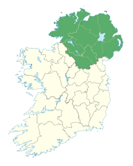
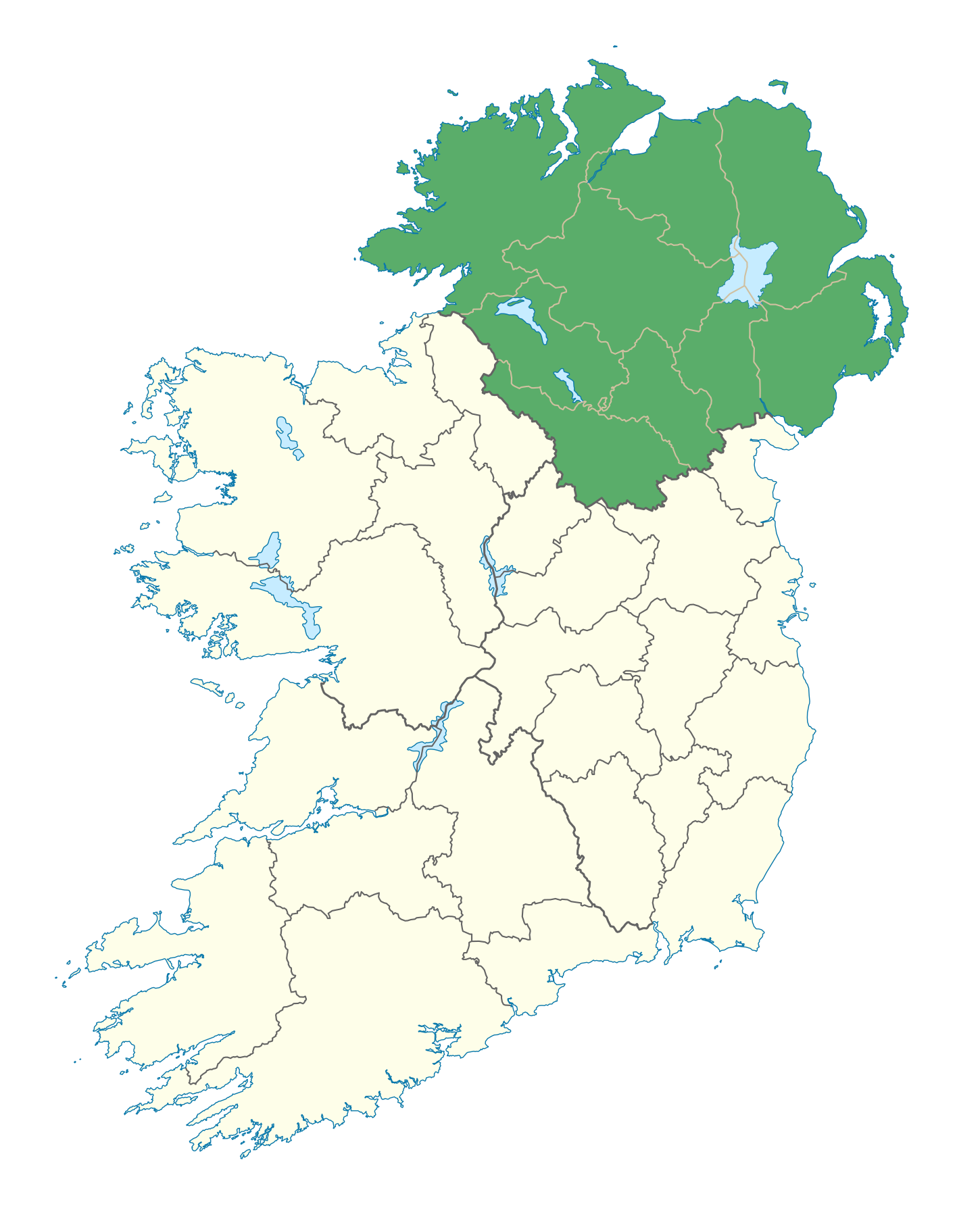
| 描述 | Locator map of Ulster. |
| 日期 | (UTC) |
| 來源 | |
| 作者 |
|
協議
我,呢份作品嘅作者,決定用以下許可發佈呢件作品:
呢個檔案用共享創意 姓名標示-非商業性-相同方式分享3.0 未本地化版本條款授權。
- 你可以:
- 去分享 – 複製、發佈同傳播呢個作品
- 再改 – 創作演繹作品
- 要遵照下面嘅條件:
- 署名 – 你一定要畀合適嘅表彰、畀返指向呢個授權條款嘅連結,同埋寫明有無改過嚟。你可以用任何合理方式去做,但唔可以用任何方式暗示授權人認可咗你或者你嘅使用方式。
- 相同方式分享 – 如果你用任何方式改過呢個作品,你必須要用返原本或者相似嘅條款發佈。
檔案歷史
撳個日期/時間去睇響嗰個時間出現過嘅檔案。
| 日期/時間 | 縮圖 | 尺寸 | 用戶 | 註解 | |
|---|---|---|---|---|---|
| 現時 | 2012年1月7號 (六) 19:49 | | 1,450 × 1,807(699 KB) | NikNaks | Fix |
| 2012年1月7號 (六) 18:31 |  | 1,450 × 1,807(700 KB) | NikNaks | Remove modern boundaries | |
| 2012年1月7號 (六) 18:27 |  | 1,450 × 1,807(720 KB) | NikNaks | Updating with new map | |
| 2012年1月7號 (六) 17:50 |  | 400 × 500(281 KB) | NikNaks93 | == {{int:filedesc}} == {{Information |Description=Locator map of Ulster. |Source=*File:Ireland_trad_counties_named.svg |Date=2012-01-07 17:50 (UTC) |Author=*File:Ireland_trad_counties_named.svg: *[[:File:Population_density_of_Ireland_map2002.s |
檔案用途
以下嘅1版用到呢個檔:
全域檔案使用情況
下面嘅維基都用緊呢個檔案:
- ar.wikipedia.org嘅使用情況
- ast.wikipedia.org嘅使用情況
- az.wikipedia.org嘅使用情況
- bg.wikipedia.org嘅使用情況
- ca.wikipedia.org嘅使用情況
- ceb.wikipedia.org嘅使用情況
- cs.wikipedia.org嘅使用情況
- el.wikipedia.org嘅使用情況
- en.wikipedia.org嘅使用情況
- Ulster
- Sperrins
- List of Ireland-related topics
- Mourne Mountains
- Derryveagh Mountains
- Blue Stack Mountains
- Slieve Croob
- Lists of mountains in Ireland
- Fair Head
- Errigal
- Slieve Donard
- Divis
- Slieve League
- Binevenagh
- Slemish
- Glenarm
- Cuilcagh
- Glenariff
- Slieve Bearnagh
- Cavehill
- Ulster Senior Football Championship
- Slieve Binnian
- Glendun
- Slieve Muck
- Slieve Gullion
- Muckish
- Seven Sisters, Donegal
- Crocknalaragagh
- Aghla Beg
- Ardloughnabrackbaddy
- Aghla More
- Mackoght
- Donald's Hill
- Black Mountain (Belfast)
- User:Danny1501
- Template:User Ulster
- Tievebulliagh
- User:Ro2000
- Slieve Beagh
- Slieve Snaght
- Sawel Mountain
- User:Weeman com
睇呢個檔案嘅更多全域使用情況。