File:Wfm southampton island.jpg

預覽大細:800 × 593 像素。 第啲解像度:320 × 237 像素|640 × 474 像素|1,024 × 758 像素|1,280 × 948 像素。
原本檔案 (1,280 × 948 像素,檔案大細:144 KB ,MIME類型:image/jpeg)
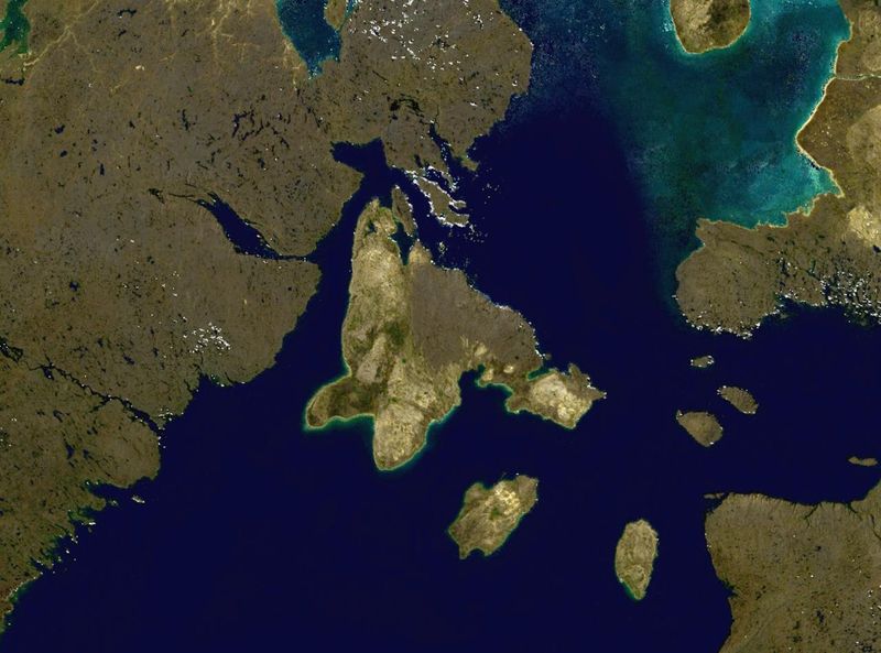
Southampton Island in northern Canada.
NASA blue pearl data, collected using NASA World Wind.
| This image is in the public domain because it is a screenshot from NASA’s globe software World Wind using a public domain layer, such as Blue Marble, MODIS, Landsat, SRTM, USGS or GLOBE.
|
 |
| Annotations | This image is annotated: View the annotations at Commons |
檔案歷史
撳個日期/時間去睇響嗰個時間出現過嘅檔案。
| 日期/時間 | 縮圖 | 尺寸 | 用戶 | 註解 | |
|---|---|---|---|---|---|
| 現時 | 2006年4月9號 (日) 16:02 | | 1,280 × 948(144 KB) | Finlay McWalter | Southampton Island in northern Canada. NASA blue pearl data, collected using NASA World Wind. {{PD-USGov-NASA}} Category:Nunavut Category:Satellite images of islands Category:Satellite pictures of Canada |
檔案用途
以下嘅1版用到呢個檔:
全域檔案使用情況
下面嘅維基都用緊呢個檔案:
- af.wikipedia.org嘅使用情況
- ar.wikipedia.org嘅使用情況
- ast.wikipedia.org嘅使用情況
- az.wikipedia.org嘅使用情況
- ba.wikipedia.org嘅使用情況
- be.wikipedia.org嘅使用情況
- bg.wikipedia.org嘅使用情況
- ca.wikipedia.org嘅使用情況
- ceb.wikipedia.org嘅使用情況
- cy.wikipedia.org嘅使用情況
- da.wikipedia.org嘅使用情況
- de.wikipedia.org嘅使用情況
- el.wikipedia.org嘅使用情況
- en.wikipedia.org嘅使用情況
- es.wikipedia.org嘅使用情況
- et.wikipedia.org嘅使用情況
- eu.wikipedia.org嘅使用情況
- fa.wikipedia.org嘅使用情況
- fi.wikipedia.org嘅使用情況
- fr.wikipedia.org嘅使用情況
- ga.wikipedia.org嘅使用情況
- gl.wikipedia.org嘅使用情況
- he.wikipedia.org嘅使用情況
- hr.wikipedia.org嘅使用情況
- hu.wikipedia.org嘅使用情況
- hy.wikipedia.org嘅使用情況
- it.wikipedia.org嘅使用情況
- ka.wikipedia.org嘅使用情況
- kk.wikipedia.org嘅使用情況
睇呢個檔案嘅更多全域使用情況。