File:Wutip 2019-02-25 0345Z.jpg
原本檔案 (4,200 × 5,600 像素,檔案大細:6.1 MB ,MIME類型:image/jpeg)
摘要
| 描述 |
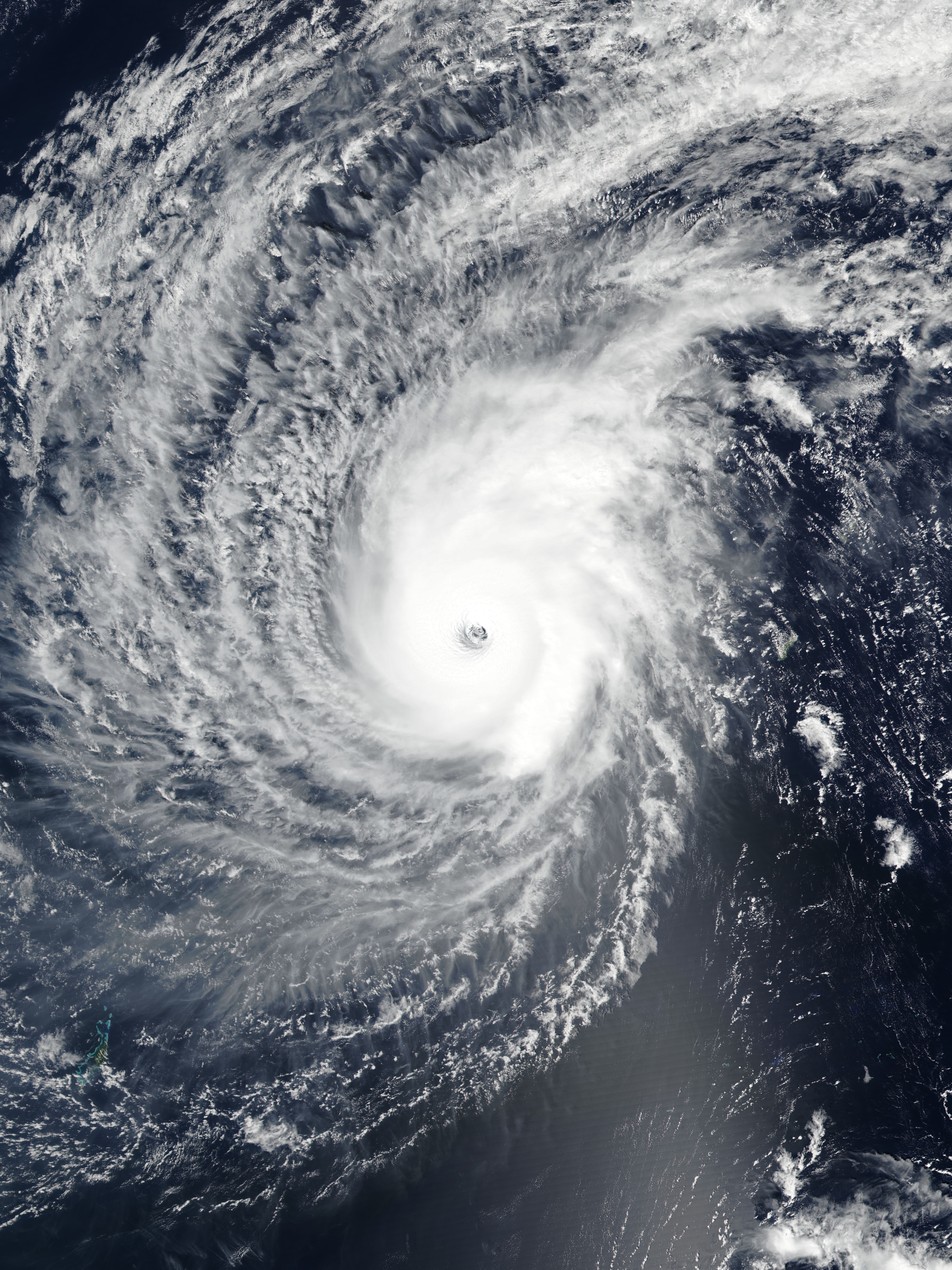
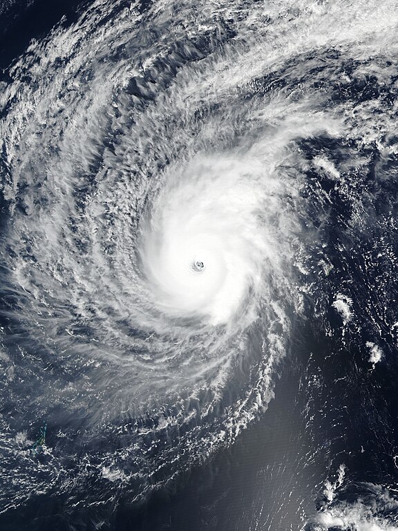
English: Typhoon Wutip near its secondary peak intensity west of Guam on February 25, 2019. |
| 日期 | |
| 來源 | EOSDIS Worldview |
| 作者 | VIIRS image captured by NOAA’s Suomi NPP satellite |
| Camera location | | View this and other nearby images on: OpenStreetMap |
|---|
協議
| This file is in the public domain in the United States because it was solely created by NASA. NASA copyright policy states that "NASA material is not protected by copyright unless noted". (See Template:PD-USGov, NASA copyright policy page or JPL Image Use Policy.) | ||
 |
Warnings:
|
檔案歷史
撳個日期/時間去睇響嗰個時間出現過嘅檔案。
| 日期/時間 | 縮圖 | 尺寸 | 用戶 | 註解 | |
|---|---|---|---|---|---|
| 現時 | 2019年2月25號 (一) 13:58 | | 4,200 × 5,600(6.1 MB) | Meow | Rebuilt and optimised the picture with the accurate resolution (375m), the proper ratio (also narrowed to 97.6%), and the correct location of the center. |
| 2019年2月25號 (一) 11:49 |  | 6,401 × 8,001(3.84 MB) | Nino Marakot | 250m resolution | |
| 2019年2月25號 (一) 07:29 |  | 1,324 × 1,839(350 KB) | ElenaCyclone | User created page with UploadWizard |
檔案用途
以下嘅2版用到呢個檔:
全域檔案使用情況
下面嘅維基都用緊呢個檔案:
- en.wikipedia.org嘅使用情況
- Portal:Tropical cyclones/Anniversaries/February
- Portal:Tropical cyclones/Anniversaries/February/23
- Wikipedia:WikiProject Tropical cyclones/Newsletter/Archive 35
- User talk:CooperScience
- User talk:KN2731/Archive 2
- Tropical cyclones in 2019
- User talk:Hurricane Noah/Archive 2
- User talk:Nova Crystallis/Archive 5
- User talk:Yellow Evan/Archive 28
- es.wikipedia.org嘅使用情況
- ja.wikipedia.org嘅使用情況
- ko.wikipedia.org嘅使用情況
- pt.wikipedia.org嘅使用情況
- th.wikipedia.org嘅使用情況
- tl.wikipedia.org嘅使用情況
- zh.wikipedia.org嘅使用情況