File:7 zones dels ciclons tropicals.jpg
預覽大細:800 × 332 像素。 第啲解像度:320 × 133 像素|640 × 265 像素|1,780 × 738 像素。
原本檔案 (1,780 × 738 像素,檔案大細:273 KB ,MIME類型:image/jpeg)
| 描述 |
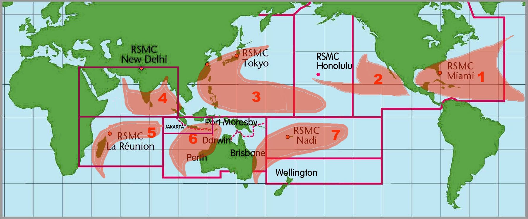
English: Images of the seven tropical cyclone basins where storms occur on a regular basis around the world and the corresponding Regional Specialized Meteorological Center.
Català: Mapamundi amb les 7 àrees on s'originen ciclons tropicals. |
|||
| 日期 | (UTC) | |||
| 來源 | Atlantic Oceanographic and Meteorological laboratory | |||
| 作者 | National Oceanic and Atmospheric Administration | |||
| 許可 (重用呢個檔案) |
|
|||
| Other versions | Image:6RSMCs.jpg |

|
This meteorology image could be recreated using vector graphics as an SVG file. This has several advantages; see Commons:Media for cleanup for more information. If an SVG form of this image is already available, please upload it. After uploading an SVG, replace this template with {{vector version available|new image name.svg}}.
|


檔案歷史
撳個日期/時間去睇響嗰個時間出現過嘅檔案。
| 日期/時間 | 縮圖 | 尺寸 | 用戶 | 註解 | |
|---|---|---|---|---|---|
| 現時 | 2010年6月6號 (日) 02:34 | | 1,780 × 738(273 KB) | Jason Rees | Updated the basin boundaries Added Jakarta and updated RSMC New Delhi's Perth and Reunions boundaries. |
| 2005年10月22號 (六) 00:08 |  | 1,780 × 738(211 KB) | Xadaga | {{DP-NOAA}} Mapamundi amb les 7 àrees on s'originen ciclons tropicals. Imatge extreta de la NOAA. [http://www.aoml.noaa.gov/hrd/tcfaq/F1.html] |
檔案用途
以下嘅1版用到呢個檔:
全域檔案使用情況
下面嘅維基都用緊呢個檔案:
- ca.wikipedia.org嘅使用情況
- de.wikipedia.org嘅使用情況
- en.wikivoyage.org嘅使用情況
- es.wikipedia.org嘅使用情況
- es.wikivoyage.org嘅使用情況
- fr.wikipedia.org嘅使用情況
- he.wikivoyage.org嘅使用情況
- ja.wikipedia.org嘅使用情況
- ko.wikipedia.org嘅使用情況
- ms.wikipedia.org嘅使用情況
- no.wikipedia.org嘅使用情況
- pt.wikipedia.org嘅使用情況
- ru.wikipedia.org嘅使用情況
- sh.wikipedia.org嘅使用情況
- simple.wikipedia.org嘅使用情況
- sr.wikipedia.org嘅使用情況
- th.wikipedia.org嘅使用情況
- uk.wikipedia.org嘅使用情況
- zh.wikipedia.org嘅使用情況