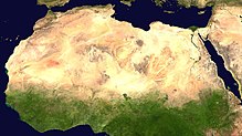
File:Africa satellite plane.jpg
原本檔案 (8,460 × 8,900 像素,檔案大細:7.34 MB ,MIME類型:image/jpeg)
檔案歷史
撳個日期/時間去睇響嗰個時間出現過嘅檔案。
| 日期/時間 | 縮圖 | 尺寸 | 用戶 | 註解 | |
|---|---|---|---|---|---|
| 現時 | 2005年3月28號 (一) 00:46 |  | 8,460 × 8,900(7.34 MB) | Dbenbenn | original high-resolution version, cropped land_shallow_topo_west.tif at 8460x8900+19400+6200 |
| 2004年11月13號 (六) 21:08 |  | 741 × 800(113 KB) | Bjarki S |
檔案用途
無嘢連來呢份檔案。
全域檔案使用情況
下面嘅維基都用緊呢個檔案:
- ace.wikipedia.org嘅使用情況
- af.wikipedia.org嘅使用情況
- als.wikipedia.org嘅使用情況
- ar.wikipedia.org嘅使用情況
- ar.wikinews.org嘅使用情況
- ast.wikipedia.org嘅使用情況
- azb.wikipedia.org嘅使用情況
- az.wikipedia.org嘅使用情況
- az.wikiquote.org嘅使用情況
- ba.wikipedia.org嘅使用情況
- be.wikipedia.org嘅使用情況
- bm.wikipedia.org嘅使用情況
- ca.wikiquote.org嘅使用情況
- cdo.wikipedia.org嘅使用情況
- co.wikipedia.org嘅使用情況
- cv.wikipedia.org嘅使用情況
- da.wikipedia.org嘅使用情況
- de.wikipedia.org嘅使用情況
- Oldowan
- CFA-Franc-Zone
- Fußball in Südafrika
- Portal:Afrika
- Wikipedia:Archiv/Qualitätsoffensive/Afrika
- Wikipedia:WikiProjekt Afrika
- Wikipedia Diskussion:WikiProjekt Afrika
- Uganda Olympic Committee
- Wikipedia:WikiProjekt Sudan
- Portal:Afrika/Unsere besten Artikel
- Wikipedia:WikiProjekt Äthiopien
- Portal:Gambia
- Fußball in Äthiopien
- Wikipedia:WikiProjekt Sudan/Verwandte
- Portal:Afrika/Register
- Benutzer:Vorlage/Herkunftsvorlagen
- Portal:Hip-Hop
- Portal:Hip-Hop/Hip-Hop nach Ländern
- Namibia National Olympic Committee
- Fußball
- Benutzer:Heiteck
- Benutzer:Vorlage/aus Afrika
- Gambia National Olympic Committee
- Portal:Nigeria
- Fußball in Lesotho
- Fußball in Burkina Faso
睇呢個檔案嘅更多全域使用情況。


