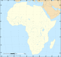
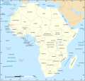
File:African continent-en.svg

呢個「SVG」檔案嘅呢個「PNG」預覽嘅大細:635 × 600 像素。 第啲解像度:254 × 240 像素|508 × 480 像素|813 × 768 像素|1,084 × 1,024 像素|2,169 × 2,048 像素|1,525 × 1,440 像素。
原本檔案 (SVG檔案,表面大細: 1,525 × 1,440 像素,檔案大細:752 KB)
檔案歷史
撳個日期/時間去睇響嗰個時間出現過嘅檔案。
| 日期/時間 | 縮圖 | 尺寸 | 用戶 | 註解 | |
|---|---|---|---|---|---|
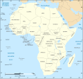
| 現時 | 2020年12月6號 (日) 18:21 |  | 1,525 × 1,440(752 KB) | Sting | Swatziland => eSwatini |
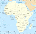
| 2011年7月14號 (四) 19:59 |  | 1,525 × 1,440(752 KB) | Sting | Sudan/South Sudan 2011-07 border update | |
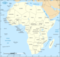
| 2010年12月16號 (四) 16:42 |  | 1,525 × 1,440(747 KB) | Sting | Spelling correction: Madeira | |
| 2009年1月10號 (六) 20:16 |  | 1,525 × 1,440(747 KB) | Sting | Correction Sao Tome | |
| 2008年12月6號 (六) 08:37 |  | 1,525 × 1,440(750 KB) | Bobarino | {{Information |Description={{en|Map of the African continent.}} {{fr|Carte vierge du continent africain.}} Lambert azimutal equal-area projection, WGS84 datum, standard meridian: 15°E, standard pa |
檔案用途
無嘢連來呢份檔案。
全域檔案使用情況
下面嘅維基都用緊呢個檔案:
- af.wikipedia.org嘅使用情況
- ar.wikipedia.org嘅使用情況
- azb.wikipedia.org嘅使用情況
- az.wiktionary.org嘅使用情況
- de.wikipedia.org嘅使用情況
- en.wikipedia.org嘅使用情況
- fa.wikipedia.org嘅使用情況
- hi.wikipedia.org嘅使用情況
- hu.wikibooks.org嘅使用情況
- id.wikipedia.org嘅使用情況
- ig.wikipedia.org嘅使用情況
- ilo.wikipedia.org嘅使用情況
- ja.wikipedia.org嘅使用情況
- ko.wikipedia.org嘅使用情況
- www.mediawiki.org嘅使用情況
- ml.wikipedia.org嘅使用情況
- mn.wikipedia.org嘅使用情況
- nl.wikipedia.org嘅使用情況
- simple.wikipedia.org嘅使用情況
- sw.wikipedia.org嘅使用情況
- te.wikipedia.org嘅使用情況
- th.wikipedia.org嘅使用情況
- tly.wikipedia.org嘅使用情況
- tr.wikipedia.org嘅使用情況
- uz.wikipedia.org嘅使用情況
- yo.wikipedia.org嘅使用情況
