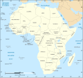
File:African continent-fr.svg

呢個「SVG」檔案嘅呢個「PNG」預覽嘅大細:635 × 600 像素。 第啲解像度:254 × 240 像素|508 × 480 像素|813 × 768 像素|1,084 × 1,024 像素|2,169 × 2,048 像素|1,525 × 1,440 像素。
原本檔案 (SVG檔案,表面大細: 1,525 × 1,440 像素,檔案大細:741 KB)
檔案歷史
撳個日期/時間去睇響嗰個時間出現過嘅檔案。
| 日期/時間 | 縮圖 | 尺寸 | 用戶 | 註解 | |
|---|---|---|---|---|---|
| 現時 | 2020年12月6號 (日) 18:25 | 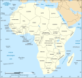 | 1,525 × 1,440(741 KB) | Sting | Swatziland => eSwatini ; retour aux couleurs standard |
| 2019年7月1號 (一) 11:07 |  | 1,525 × 1,440(740 KB) | The RedBurn | Darker blacks, -color profile local link | |
| 2011年7月14號 (四) 19:39 |  | 1,525 × 1,440(740 KB) | Sting | Sudan/South Sudan 2011-07 border update | |
| 2009年3月12號 (四) 21:28 |  | 1,525 × 1,440(755 KB) | Sting | Correction Sao Tome (again) ; all fonts in DejaVu condensed | |
| 2009年1月10號 (六) 19:52 |  | 1,525 × 1,440(749 KB) | Sting | Correction Sao Tome | |
| 2008年6月27號 (五) 21:24 |  | 1,525 × 1,440(751 KB) | Sting | "Rép. du Congo" name correction | |
| 2008年6月27號 (五) 01:46 |  | 1,525 × 1,440(750 KB) | Sting | One name correction | |
| 2008年6月26號 (四) 23:37 |  | 1,525 × 1,440(750 KB) | Sting | Completely new drawing with known projection ; new colors | |
| 2006年5月31號 (三) 22:56 |  | 1,390 × 1,295(612 KB) | Sting | {{Information |Description=Political map of the African continent with French caption |Source=Several bitmap-type maps |Date= May 2006 |Author= Eric Gaba (Sting) |Permission=GFDL or CC-BY-SA |other_versions=[[:I |
檔案用途
無嘢連來呢份檔案。
全域檔案使用情況
下面嘅維基都用緊呢個檔案:
- bm.wikipedia.org嘅使用情況
- fr.wikipedia.org嘅使用情況
- Afrique
- Liste des colonies françaises
- Géographie de l'Afrique
- Liste de points extrêmes de l'Afrique
- Discussion utilisateur:Eunostos
- Discussion utilisateur:Pradigue/Archives 24/Archives 22/Archives 19/Archives 3
- Wikipédia:Atelier graphique/Cartes/Archives/décembre 2013
- Wikipédia:Atelier graphique/Cartes/Archives/mars 2016
- Utilisateur:Exp JC/Brouillon
- Utilisateur:Ypirétis/Archives 2017-2020
- ko.wikipedia.org嘅使用情況
- mg.wikipedia.org嘅使用情況
