原本檔案 (SVG檔案,表面大細: 1,525 × 1,440 像素,檔案大細:745 KB)

摘要

描述
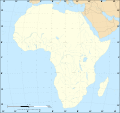
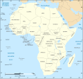
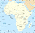
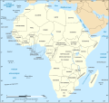
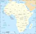
English: Political map of Africa in Norwegian (Bokmål).
Norsk bokmål: Politisk kart over Afrika på bokmål.

Lambert azimutal equal-area projection, WGS84 datum, standard meridian: 15°E, standard parallel: 0°

Scale: 1:15,000,000 (accuracy: 3,75 km)
日期 19 December 2007 (June 2008 for the new version), updated 07/2011
來源

Image:African continent-fr.svg
Data source:

  • VMap-0
  • NGDC World Data Bank II
作者 Eric Gaba (translated by Jon Harald Søby)
許可
(重用呢個檔案)
GFDL & CC-by-SA
Other versions

[]


Translate this file This SVG file contains embedded text that can be translated into your language, using any capable SVG editor, text editor or the SVG Translate tool. For more information see: About translating SVG files.

協議

I, the copyright holder of this work, hereby publish it under the following licenses:
GNU head 根據自由軟體基金會發佈嘅無固定段落、封面文字同封底文字GNU自由文件授權條款第1.2或打後嘅版本,你獲授權可以重製、散佈同埋修改爾份文件。授權條款嘅副本喺章節GNU自由文件授權條款
w:en:Creative Commons
署名 相同方式分享
呢個檔案用共享創意 姓名標示-非商業性-相同方式分享3.0 未本地化版本條款授權。
你可以:
  • 去分享 – 複製、發佈同傳播呢個作品
  • 再改 – 創作演繹作品
要遵照下面嘅條件:
  • 署名 – 你一定要畀合適嘅表彰、畀返指向呢個授權條款嘅連結,同埋寫明有無改過嚟。你可以用任何合理方式去做,但唔可以用任何方式暗示授權人認可咗你或者你嘅使用方式。
  • 相同方式分享 – 如果你用任何方式改過呢個作品,你必須要用返原本或者相似嘅條款發佈。
This licensing tag was added to this file as part of the GFDL licensing update.
w:en:Creative Commons
署名 相同方式分享
This file is licensed under the Creative Commons Attribution-Share Alike 2.5 Generic, 2.0 Generic and 1.0 Generic license.
你可以:
  • 去分享 – 複製、發佈同傳播呢個作品
  • 再改 – 創作演繹作品
要遵照下面嘅條件:
  • 署名 – 你一定要畀合適嘅表彰、畀返指向呢個授權條款嘅連結,同埋寫明有無改過嚟。你可以用任何合理方式去做,但唔可以用任何方式暗示授權人認可咗你或者你嘅使用方式。
  • 相同方式分享 – 如果你用任何方式改過呢個作品,你必須要用返原本或者相似嘅條款發佈。
你可以揀你想用嘅牌照。

Captions

Add a one-line explanation of what this file represents

Items portrayed in this file

圖中顯示嘅係

image/svg+xml

a1d38fefa97c2ff434dd28d89cf49a56c0847190

762,407 字節

1,440 像素

1,525 像素

檔案歷史

撳個日期/時間去睇響嗰個時間出現過嘅檔案。

日期/時間縮圖尺寸用戶註解
現時2020年12月6號 (日) 18:30響2020年12月6號 (日) 18:30嘅縮圖版本1,525 × 1,440(745 KB)StingSwatziland => eSwatini
2011年7月20號 (三) 20:02響2011年7月20號 (三) 20:02嘅縮圖版本1,525 × 1,440(749 KB)StingSudan/South Sudan 2011-07 border update
2009年1月12號 (一) 16:14響2009年1月12號 (一) 16:14嘅縮圖版本1,525 × 1,440(757 KB)Jon Harald SøbyRemoving miles from key
2009年1月10號 (六) 20:13響2009年1月10號 (六) 20:13嘅縮圖版本1,525 × 1,440(744 KB)StingCorrection Sao Tome
2008年6月27號 (五) 02:46響2008年6月27號 (五) 02:46嘅縮圖版本1,525 × 1,440(744 KB)StingCompletely new drawing with known projection ; new colors
2007年12月19號 (三) 21:05響2007年12月19號 (三) 21:05嘅縮圖版本1,390 × 1,295(611 KB)Jon Harald Søby{{Information |Description={{en|Political map of w:Africa in Norwegian (Bokmål).}} {{nb|Politisk kart over Afrika på bokmål.}} |Source=Image:African continent-fr.svg |Date=19 December 2007 |Author=Eric Gaba (tra

無嘢連來呢份檔案。

全域檔案使用情況

下面嘅維基都用緊呢個檔案:

  • no.wikipedia.org嘅使用情況

Metadata