File:AmesRangeMap.jpg

預覽大細:750 × 600 像素。 第啲解像度:300 × 240 像素|600 × 480 像素|1,000 × 800 像素。
原本檔案 (1,000 × 800 像素,檔案大細:165 KB ,MIME類型:image/jpeg)
摘要
| 描述 |
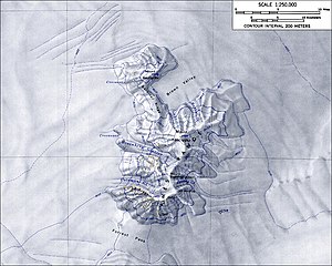
English: Topographical map of the Ames Range
From http://usarc.usgs.gov/antarctic_atlas/ |
| 來源 | Transferred from en.wikipedia to Commons. See also 1:250 000 map of Mount Kosciusko from the USGS. |
| 作者 |
協議
This image is in the public domain in the United States because it only contains materials that originally came from the United States Geological Survey, an agency of the United States Department of the Interior. For more information, see the official USGS copyright policy.
|
Original upload log
The original description page was here. All following user names refer to en.wikipedia.
- 2005-01-04 15:51 GarciaB 1000×800×8 (169185 bytes) Topographic map of the Ames Range (1:250,000 scale)
檔案歷史
撳個日期/時間去睇響嗰個時間出現過嘅檔案。
| 日期/時間 | 縮圖 | 尺寸 | 用戶 | 註解 | |
|---|---|---|---|---|---|
| 現時 | 2008年2月5號 (二) 20:01 | | 1,000 × 800(165 KB) | Alison | {{Information |Description={{en|Topographical map of the Ames Range From http://usarc.usgs.gov/antarctic_atlas/}} |Source=Transferred from [http://en.wikipedia.org en.wikipedia] |Date=2005-01-04 (original upload date) |Author=Original uploader was [[:en: |
檔案用途
以下嘅1版用到呢個檔:
全域檔案使用情況
下面嘅維基都用緊呢個檔案:
- ca.wikipedia.org嘅使用情況
- ceb.wikipedia.org嘅使用情況
- de.wikipedia.org嘅使用情況
- en.wikipedia.org嘅使用情況
- es.wikipedia.org嘅使用情況
- fr.wikipedia.org嘅使用情況
- ga.wikipedia.org嘅使用情況
- hu.wikipedia.org嘅使用情況
- id.wikipedia.org嘅使用情況
- lld.wikipedia.org嘅使用情況
- mk.wikipedia.org嘅使用情況
- nn.wikipedia.org嘅使用情況
- no.wikipedia.org嘅使用情況
- pt.wikipedia.org嘅使用情況
- uk.wikipedia.org嘅使用情況
- www.wikidata.org嘅使用情況
- zh.wikipedia.org嘅使用情況