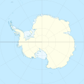
File:Antarctica location map.svg

呢個「SVG」檔案嘅呢個「PNG」預覽嘅大細:600 × 600 像素。 第啲解像度:240 × 240 像素|480 × 480 像素|768 × 768 像素|1,024 × 1,024 像素|2,048 × 2,048 像素|1,200 × 1,200 像素。
原本檔案 (SVG檔案,表面大細: 1,200 × 1,200 像素,檔案大細:233 KB)
檔案歷史
撳個日期/時間去睇響嗰個時間出現過嘅檔案。
| 日期/時間 | 縮圖 | 尺寸 | 用戶 | 註解 | |
|---|---|---|---|---|---|
| 現時 | 2015年4月9號 (四) 00:31 |  | 1,200 × 1,200(233 KB) | Ravenpuff | Minor changes |
| 2011年5月3號 (二) 16:16 |  | 1,200 × 1,200(232 KB) | Alexrk2 | - | |
| 2011年5月3號 (二) 16:14 |  | 1,200 × 1,200(232 KB) | Alexrk2 | + Peter I. Insel | |
| 2010年2月21號 (日) 14:24 |  | 1,200 × 1,200(217 KB) | Alexrk2 | == Summary == {{Information |Description= {{de|Positionskarte Antarktis, Mittabstandstreue Azimutalprojektion}} {{en|Location map Antarctica, Azimuthal equidistant projection}} * Longitude of central meridian: 0° * La |
檔案用途
以下嘅1版用到呢個檔:
全域檔案使用情況
下面嘅維基都用緊呢個檔案:
- af.wikipedia.org嘅使用情況
- ar.wikipedia.org嘅使用情況
- arz.wikipedia.org嘅使用情況
- ast.wikipedia.org嘅使用情況
- Monte Hope (L'Antártida)
- Base Vostok
- Base Antártica Xuan Carlos I
- Base Concordia
- Monte Erebus
- Macizu Vinson
- Montes Tresantárticos
- Módulu:Mapa de llocalización/datos/Antártida
- Módulu:Mapa de llocalización/datos/Antártida/usu
- Picu del Príncipe d'Asturies
- Aeródromu Teniente Rodolfo Marsh Martin
- Aeródromu Wilkins
- Aeródromu de Molodiózhnaya
- Aeródromu de Punta Rothera
- Aeródromu de Troll
- Base Casey
- Base Davis
- Base Edgeworth David
- Base Fossil Bluff
- Base Halley
- Base Mario Zucchelli
- Base Mawson
- Base N
- Base Plateau
- Base SANAE IV
- Campamentu Glaciar Unión
- Estación Kohnen
- Islla Cacho
- av.wikipedia.org嘅使用情況
- az.wikipedia.org嘅使用情況
睇呢個檔案嘅更多全域使用情況。


