File:Cambodia Battambang locator map.svg

呢個「SVG」檔案嘅呢個「PNG」預覽嘅大細:664 × 600 像素。 第啲解像度:266 × 240 像素|531 × 480 像素|850 × 768 像素|1,133 × 1,024 像素|2,267 × 2,048 像素|1,347 × 1,217 像素。
原本檔案 (SVG檔案,表面大細: 1,347 × 1,217 像素,檔案大細:748 KB)
| 描述 |
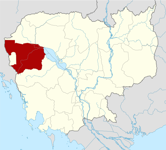
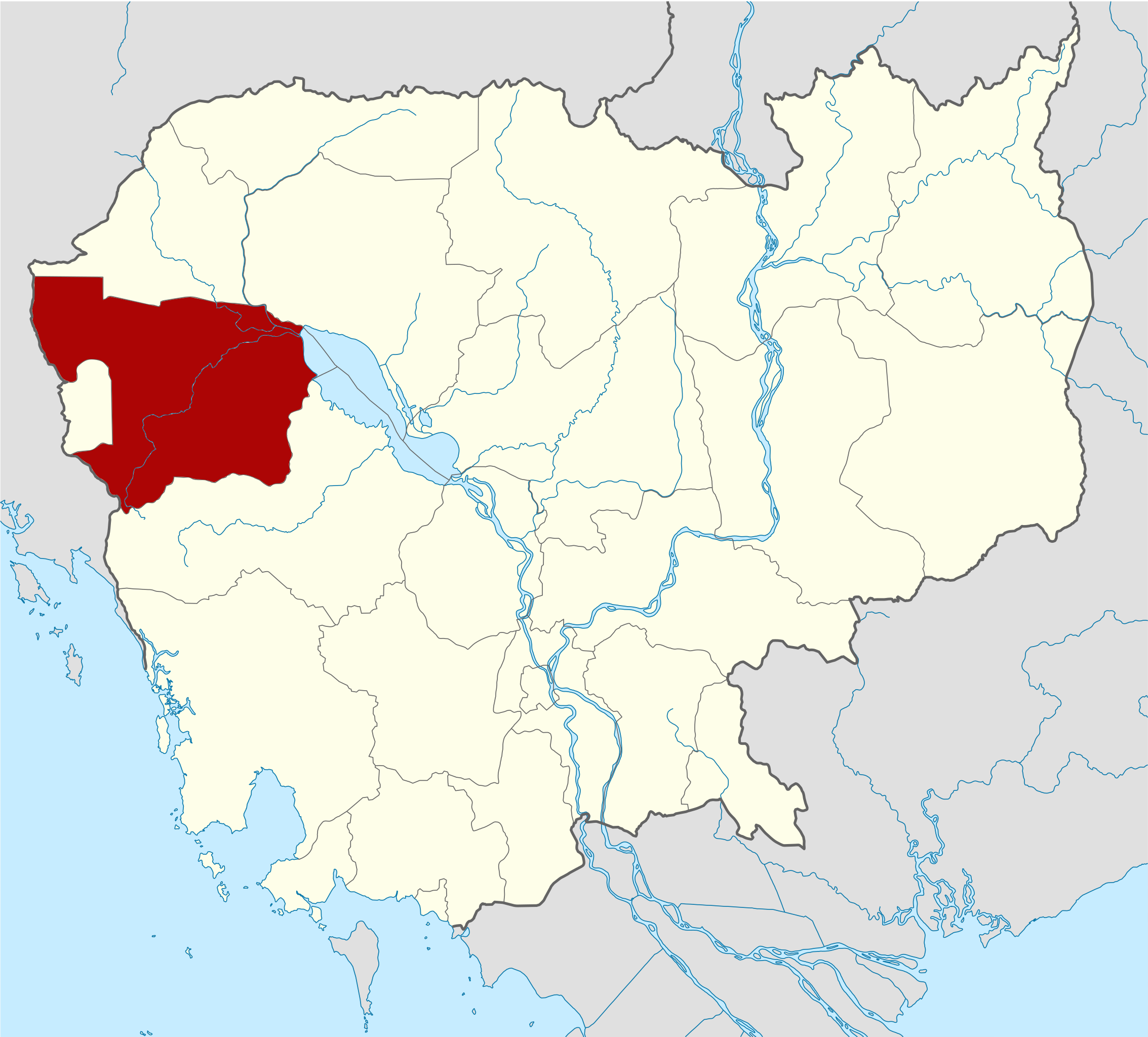
Deutsch: Positionskarte von Kambodscha Quadratische Plattkarte, N-S-Streckung 105 %. Geographische Begrenzung der Karte: * N: 14.8° N * S: 9.9° N * W: 102.2° O * O: 107.9° O Equirectangular projection, N/S stretching 105 %. Geographic limits of the map: * N: 14.8° N * S: 9.9° N * W: 102.2° E * E: 107.9° E |
| 日期 | (UTC) |
| 來源 | Own work based on: Cambodia location map.svg by NordNordWest |
| 作者 | Kmusser |
| SVG genesis | This W3C-invalid locator map was created with Adobe Illustrator, and with Inkscape. |
| This is a retouched picture, which means that it has been digitally altered from its original version. Modifications: highlighted Battambang Province. The original can be viewed here: Cambodia location map.svg:
|
I, the copyright holder of this work, hereby publish it under the following licenses:
呢個檔案用共享創意 姓名標示-非商業性-相同方式分享3.0 未本地化版本條款授權。
- 你可以:
- 去分享 – 複製、發佈同傳播呢個作品
- 再改 – 創作演繹作品
- 要遵照下面嘅條件:
- 署名 – 你一定要畀合適嘅表彰、畀返指向呢個授權條款嘅連結,同埋寫明有無改過嚟。你可以用任何合理方式去做,但唔可以用任何方式暗示授權人認可咗你或者你嘅使用方式。
- 相同方式分享 – 如果你用任何方式改過呢個作品,你必須要用返原本或者相似嘅條款發佈。

|
根據自由軟體基金會發佈嘅無固定段落、封面文字同封底文字GNU自由文件授權條款第1.2或打後嘅版本,你獲授權可以重製、散佈同埋修改爾份文件。授權條款嘅副本喺章節GNU自由文件授權條款。 |
你可以揀你想用嘅牌照。
Original upload log
This image is a derivative work of the following images:
- File:Cambodia_location_map.svg licensed with Cc-by-sa-3.0, GFDL
- 2009-02-12T21:35:03Z NordNordWest 1347x1217 (728478 Bytes) smaller file
- 2009-02-12T20:56:36Z NordNordWest 1347x1216 (1074945 Bytes) {{Information |Description= {{de|Positionskarte von [[:de:Kambodscha|Kambodscha]]}} Quadratische Plattkarte, N-S-Streckung 105 %. Geographische Begrenzung der Karte: * N: 14.8° N * S: 9.9° N * W: 102.2° O * O: 107.9° O {{
檔案歷史
撳個日期/時間去睇響嗰個時間出現過嘅檔案。
| 日期/時間 | 縮圖 | 尺寸 | 用戶 | 註解 | |
|---|---|---|---|---|---|
| 現時 | 2010年6月8號 (二) 15:16 | | 1,347 × 1,217(748 KB) | Kmusser | {{Information |Description={{de|Positionskarte von Kambodscha}} Quadratische Plattkarte, N-S-Streckung 105 %. Geographische Begrenzung der Karte: * N: 14.8° N * S: 9.9° N * W: 102.2° O * O: 107.9° O {{en|Location map of [[:en:Cambod |
檔案用途
以下嘅1版用到呢個檔:
全域檔案使用情況
下面嘅維基都用緊呢個檔案:
- ar.wikipedia.org嘅使用情況
- bg.wikipedia.org嘅使用情況
- ceb.wikipedia.org嘅使用情況
- en.wikipedia.org嘅使用情況
- Battambang province
- Battambang
- Samlaut Multiple Use Area
- Banan district, Battambang
- Thma Koul District
- Bavel District
- Moung Ruessei district
- Moung Ruessei
- Rotanak Mondol District
- Sangkae District
- Samlout District
- Sampov Lun District
- Phnum Proek district
- Kamrieng district
- Koas Krala district
- Template:Battambang province
- Battambang municipality
- Kantueu Muoy
- Kantueu Pir
- Bay Damram
- Chheu Teal
- Chaeng Mean Chey
- Phnum Sampov
- Snoeng
- Ta Kream
- Ta Pung
- Ta Meun
- Ou Ta Ki
- Chrey, Thma Koul
- Anlong Run
- Chrouy Sdau
- Boeng Pring
- Kouk Khmum
- Bansay Traeng
- Rung Chrey
- Tuol Ta Aek
- Preaek Preah Sdach
- Rotanak
- Chamkar Samraong
- Sla Kaet
- Kdol Doun Teav
- Ou Mal
- Voat Kor
- Ou Char
- Svay Pao
- Bavel (commune)
- Khnach Romeas
睇呢個檔案嘅更多全域使用情況。