File:Egypt relief location map.jpg

預覽大細:650 × 599 像素。 第啲解像度:260 × 240 像素|520 × 480 像素|833 × 768 像素|1,055 × 973 像素。
原本檔案 (1,055 × 973 像素,檔案大細:459 KB ,MIME類型:image/jpeg)
摘要
| 描述 |
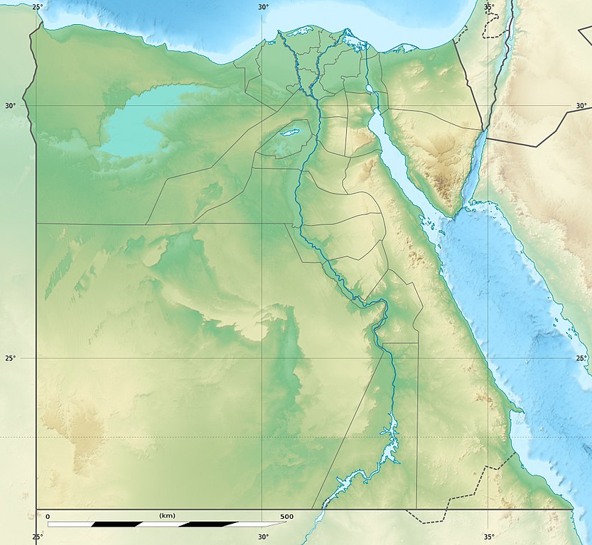
Deutsch: Relief Positionskarte von Ägypten
English: Physical location map of Egypt.
Français : Carte physique vierge destinée à la géolocalisation de l'Égypte telle que depuis le 14 avril 2011 suite à la dissolution des gouvernorats du 6 Octobre et de Helwan. Topographic scale: 1:4,932,000 (precision: 1,233 m)
Geographic limits of the map:
|
||
| 日期 | 2010-03, updated 2014-06 | ||
| 來源 |
Topographic background map: Own work
|
||
| 作者 | Eric Gaba (Sting - fr:Sting) and NordNordWest | ||
| 許可 (重用呢個檔案) |
|
||
| Other versions |
Derivative works of this file: Lower Egypt ancient nomes position map.jpg
|


| Camera location | | View this and other nearby images on: OpenStreetMap |
|---|

|
This map has been made or improved in the German Kartenwerkstatt (Map Lab). You can propose maps to improve as well.
|
協議
I, the copyright holder of this work, hereby publish it under the following licenses:

|
根據自由軟體基金會發佈嘅無固定段落、封面文字同封底文字GNU自由文件授權條款第1.2或打後嘅版本,你獲授權可以重製、散佈同埋修改爾份文件。授權條款嘅副本喺章節GNU自由文件授權條款。 |
呢個檔案用共享創意 姓名標示-非商業性-相同方式分享3.0 未本地化版本條款授權。
- 你可以:
- 去分享 – 複製、發佈同傳播呢個作品
- 再改 – 創作演繹作品
- 要遵照下面嘅條件:
- 署名 – 你一定要畀合適嘅表彰、畀返指向呢個授權條款嘅連結,同埋寫明有無改過嚟。你可以用任何合理方式去做,但唔可以用任何方式暗示授權人認可咗你或者你嘅使用方式。
- 相同方式分享 – 如果你用任何方式改過呢個作品,你必須要用返原本或者相似嘅條款發佈。
你可以揀你想用嘅牌照。
檔案歷史
撳個日期/時間去睇響嗰個時間出現過嘅檔案。
| 日期/時間 | 縮圖 | 尺寸 | 用戶 | 註解 | |
|---|---|---|---|---|---|
| 現時 | 2017年8月18號 (五) 14:01 | | 1,055 × 973(459 KB) | Mélomène | According with [https://en.wikipedia.org/wiki/Hala%27ib_Triangle] |
| 2014年6月13號 (五) 19:53 |  | 1,055 × 973(450 KB) | Sting | Color profile | |
| 2014年6月13號 (五) 19:43 |  | 1,055 × 973(422 KB) | Sting | Updated Governorates borders shape | |
| 2011年4月18號 (一) 13:59 |  | 1,055 × 975(415 KB) | Sting | Updated after Governorats dissolution | |
| 2010年7月19號 (一) 13:30 |  | 1,055 × 973(451 KB) | Sting | Color profile | |
| 2010年3月7號 (日) 19:04 |  | 1,055 × 973(450 KB) | Sting | == {{int:filedesc}} == {{Location|26|42|00|N|30|45|00|E|scale:10000000}} <br/> {{Information |Description= {{de|Relief Positionskarte von Ägypten}} {{en|Physical location map of Egypt.}} {{fr|Carte physique vierge de l'[[:f |
檔案用途
以下嘅1版用到呢個檔:
全域檔案使用情況
下面嘅維基都用緊呢個檔案:
- als.wikipedia.org嘅使用情況
- ar.wikipedia.org嘅使用情況
- arz.wikipedia.org嘅使用情況
- ast.wikipedia.org嘅使用情況
- Canal de Suez
- Colosos de Coptos
- Muséu Exipcianu d'El Cairu
- Pirámides d'Exiptu
- Presa d'Asuán
- El Cairu
- Columna de Pompeyo
- Templu de Ramsés II (Abu Simbel)
- Módulu:Mapa de llocalización/datos/Exiptu
- Menfis
- Valle de los Reis
- Ilesia ortodoxa d'Alexandría
- Canal de los Faraones
- Biblioteca d'Alexandría
- Universidá d'al-Azhar
- Universidá d'El Cairu
- Alexandría
- Golfu d'Áqaba
- Gran Esfinxe de Guiza
- Valle de les Reines
- Gran Pirámide de Guiza
- Catacumbes de Kom el Shogafa
- Ciudadela d'El Cairu
- Península del Sinaí
- Abu Simbel
- Bibliotheca Alexandrina
- Templu d'Edfu
- Monesteriu de Santa Catalina del Monte Sinaí
- Módulu:Mapa de llocalización/datos/Exiptu/usu
- Estadiu Internacional d'El Cairu
- KV63
- Damieta
- Abu Mena
睇呢個檔案嘅更多全域使用情況。