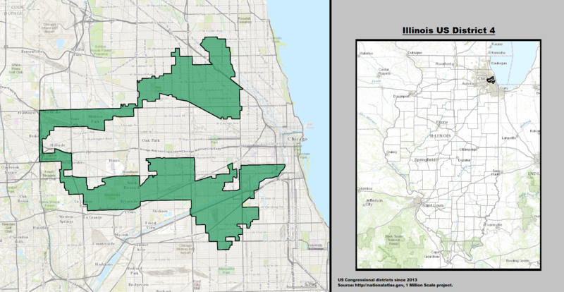
File:Illinois US Congressional District 4 (since 2013).tif
原本檔案 (1,948 × 1,008 像素,檔案大細:3.36 MB ,MIME類型:image/tiff

摘要

描述
English: Boundaries for Illinois’s 4th United States Federal Congressional District.
日期
來源 GIS shapefile data created by the United States Department of the Interior, as part of the "1 Million Scale" geospatial data project. Retrieved from: http://nationalatlas.gov/atlasftp-1m.html?openChapters=#chpbound
作者 1: GIS (congressional districts, 2013) shapefile data was created by the United States Department of the Interior. 2: Data was rendered using ArcGIS® software by Esri. 3: File developed for use on Wikipedia and elsewhere by 7partparadigm.

協議

Public domain
This map was obtained from an edition of the National Atlas of the United States. Like almost all works of the U.S. federal government, works from the National Atlas are in the public domain in the United States.
Online access: NationalAtlas.gov | 1970 print edition: Library of Congress, Perry-Castañeda Library

čeština | Deutsch | English | français | Bahasa Indonesia | italiano | македонски | മലയാളം | sicilianu | 中文 | 中文(简体)‎ | 中文(繁體)‎ | +/−

Captions

Add a one-line explanation of what this file represents

Items portrayed in this file

圖中顯示嘅係

6 4 2014

檔案歷史

撳個日期/時間去睇響嗰個時間出現過嘅檔案。

日期/時間縮圖尺寸用戶註解
現時2014年4月6號 (日) 18:56響2014年4月6號 (日) 18:56嘅縮圖版本1,948 × 1,008(3.36 MB)7partparadigmUser created page with UploadWizard

以下嘅1版用到呢個檔:

全域檔案使用情況

下面嘅維基都用緊呢個檔案:

Metadata