File:Island of Ireland location map Dublin.svg

呢個「SVG」檔案嘅呢個「PNG」預覽嘅大細:481 × 599 像素。 第啲解像度:192 × 240 像素|385 × 480 像素|616 × 768 像素|822 × 1,024 像素|1,643 × 2,048 像素|1,450 × 1,807 像素。
原本檔案 (SVG檔案,表面大細: 1,450 × 1,807 像素,檔案大細:642 KB)
| 描述 |
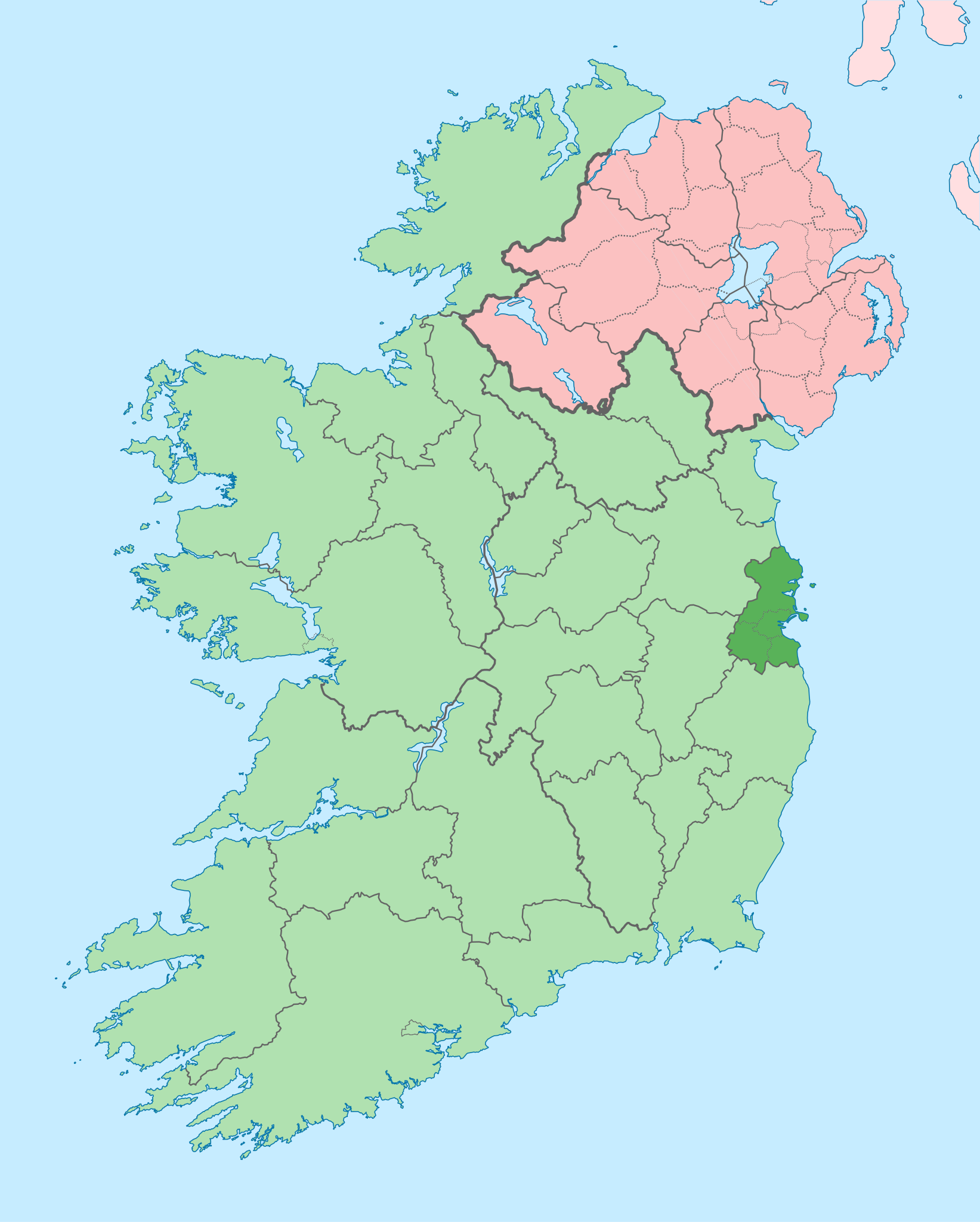
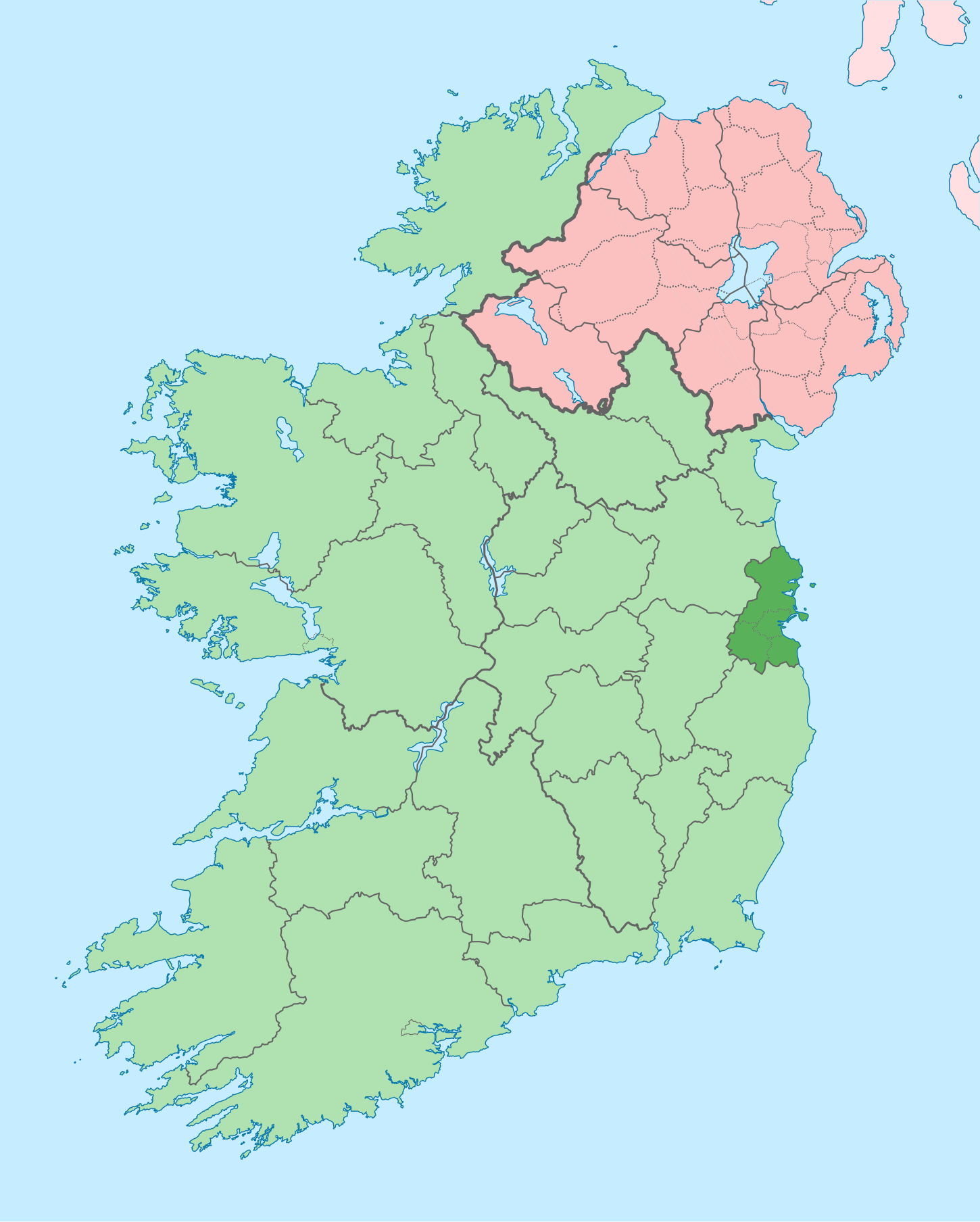
English: The island of Ireland, showing international border between Ireland and Northern Ireland, traditional provinces, traditional counties, and local authority areas in Ireland and Northern Ireland. |
| 日期 | (UTC) |
| 來源 | |
| 作者 |
|
| Other versions |
Derivative works of this file: |
| This is a retouched picture, which means that it has been digitally altered from its original version. Modifications: Coloured in regions with county of article highlighted. The original can be viewed here: Island of Ireland location map.svg:
|
我,呢份作品嘅作者,決定用以下許可發佈呢件作品:
呢個檔案用共享創意 姓名標示-非商業性-相同方式分享3.0 未本地化版本條款授權。
- 你可以:
- 去分享 – 複製、發佈同傳播呢個作品
- 再改 – 創作演繹作品
- 要遵照下面嘅條件:
- 署名 – 你一定要畀合適嘅表彰、畀返指向呢個授權條款嘅連結,同埋寫明有無改過嚟。你可以用任何合理方式去做,但唔可以用任何方式暗示授權人認可咗你或者你嘅使用方式。
- 相同方式分享 – 如果你用任何方式改過呢個作品,你必須要用返原本或者相似嘅條款發佈。
Original upload log
This image is a derivative work of the following images:
- File:Island_of_Ireland_location_map.svg licensed with Cc-by-sa-3.0
- 2010-03-06T20:43:33Z Rannpháirtí anaithnid 1450x1807 (679207 Bytes) Fix incorrectly coloured isands.
- 2010-03-03T22:19:29Z Rannpháirtí anaithnid 1450x1807 (679744 Bytes) {{Information |Description={{de|Positionskarte von [[:de:Irland|Irland]]}} Quadratische Plattkarte, N-S-Streckung 170 %. Geographische Begrenzung der Karte: * N: 55.6° N * S: 51.2° N * W: 11.0° W * O: 5.0° W {{en|Location
Uploaded with derivativeFX
檔案歷史
撳個日期/時間去睇響嗰個時間出現過嘅檔案。
| 日期/時間 | 縮圖 | 尺寸 | 用戶 | 註解 | |
|---|---|---|---|---|---|
| 現時 | 2020年7月3號 (五) 09:16 | | 1,450 × 1,807(642 KB) | Chipmunkdavis | Per the Local Government Reform Act 2014, joining both Tipperarys and both Waterfords (and removing Limerick City code). Colouring in islands, cleaning up and grouping code to remove stray objects and show Galway and Lough Ree. |
| 2010年7月19號 (一) 00:44 |  | 1,450 × 1,807(815 KB) | Mabuska | {{Information |Description={{en|The island of Ireland, showing international border between Northern Ireland and Republic of Ireland, traditional provinces, traditional counties, and local authority areas in the Republic of Ireland and Northern Ireland.}} |
檔案用途
無嘢連來呢份檔案。
全域檔案使用情況
下面嘅維基都用緊呢個檔案:
- ar.wikipedia.org嘅使用情況
- ast.wikipedia.org嘅使用情況
- bg.wikipedia.org嘅使用情況
- ca.wikipedia.org嘅使用情況
- cs.wikipedia.org嘅使用情況
- da.wikipedia.org嘅使用情況
- en.wikipedia.org嘅使用情況
- County Dublin
- Dublin
- Swords, Dublin
- Sydney Parade Avenue
- Northside, Dublin
- Southside, Dublin
- Merrion Centre, Dublin
- List of Ireland-related topics
- South Dublin
- Dún Laoghaire–Rathdown
- Fingal
- Template:County Dublin
- Tallaght
- List of Dublin postal districts
- Shenick Island
- Park Avenue, Dublin
- Kilmore West
- Greater Dublin Area
- Nutgrove
- Sutton Park, Dublin
- Man of War, Fingal
- Template:Dublin-geo-stub
- Heytesbury Street
- N32 road (Ireland)
- History of Belfast
- List of subdivisions of County Dublin
- North Wall, Dublin
- Sutton Creek (Ireland)
- Glenview, Tallaght
- Shandon, Dublin
- Ashtown Castle
- Red Gap
睇呢個檔案嘅更多全域使用情況。