File:KagoshimaMapCurrent.png

預覽大細:800 × 534 像素。 第啲解像度:320 × 213 像素|640 × 427 像素|1,024 × 683 像素|1,201 × 801 像素。
原本檔案 (1,201 × 801 像素,檔案大細:34 KB ,MIME類型:image/png)
摘要
| 描述 |
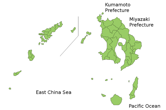
Map of Kagoshima Prefecture, Japan. Thanks to Aoki Shigenobu and [1]. Colors from Image:TokyoMapCurrent.png by User:Fg2. |
| 日期 | 2006年7月21號 (original upload date) |
| 來源 | No machine-readable source provided. Own work assumed (based on copyright claims). |
| 作者 | No machine-readable author provided. Akanemoto~commonswiki assumed (based on copyright claims). |
協議
| I, the copyright holder of this work, release this work into the public domain. This applies worldwide. In some countries this may not be legally possible; if so: I grant anyone the right to use this work for any purpose, without any conditions, unless such conditions are required by law. |
檔案歷史
撳個日期/時間去睇響嗰個時間出現過嘅檔案。
| 日期/時間 | 縮圖 | 尺寸 | 用戶 | 註解 | |
|---|---|---|---|---|---|
| 現時 | 2010年3月23號 (二) 05:17 | | 1,201 × 801(34 KB) | Alberth2 | Kajiki Town, Kamō Town and Aira Tow were merged to Aira City. |
| 2008年11月1號 (六) 02:51 |  | 1,201 × 801(34 KB) | Alberth2 | Ōkuchi and Hishikari merged to Isa. | |
| 2007年12月1號 (六) 05:27 |  | 1,201 × 801(34 KB) | Alberth2 | Kawanabe, Chiran, and Ei are merged into Minamikyūshū ity. | |
| 2007年10月5號 (五) 00:43 |  | 1,201 × 801(34 KB) | Alberth2 | Yaku Town and Kamiyaku Town have merged to Yakushima Town. | |
| 2006年7月29號 (六) 21:12 |  | 1,201 × 801(33 KB) | Akanemoto~commonswiki | fix borders | |
| 2006年7月23號 (日) 23:57 |  | 1,201 × 801(33 KB) | Akanemoto~commonswiki | ||
| 2006年7月22號 (六) 15:46 |  | 1,201 × 801(35 KB) | Akanemoto~commonswiki | ||
| 2006年7月22號 (六) 01:59 |  | 1,201 × 801(34 KB) | Akanemoto~commonswiki | ||
| 2006年7月21號 (五) 21:46 |  | 1,201 × 801(35 KB) | Akanemoto~commonswiki | added Pacific Ocean | |
| 2006年7月21號 (五) 21:32 |  | 1,201 × 801(31 KB) | Akanemoto~commonswiki |
檔案用途
無嘢連來呢份檔案。
全域檔案使用情況
下面嘅維基都用緊呢個檔案:
- az.wikipedia.org嘅使用情況
- ckb.wikipedia.org嘅使用情況
- cs.wikipedia.org嘅使用情況
- eu.wikipedia.org嘅使用情況
- fa.wikipedia.org嘅使用情況
- fr.wikipedia.org嘅使用情況
- incubator.wikimedia.org嘅使用情況
- jv.wikipedia.org嘅使用情況
- lt.wikipedia.org嘅使用情況
- no.wikipedia.org嘅使用情況
- pl.wikipedia.org嘅使用情況
- pt.wikipedia.org嘅使用情況
- ru.wikipedia.org嘅使用情況
- vi.wikipedia.org嘅使用情況