File:Map of Japan with highlight on 02edit Hokkaido prefecture.svg

呢個「SVG」檔案嘅呢個「PNG」預覽嘅大細:600 × 600 像素。 第啲解像度:240 × 240 像素|480 × 480 像素|768 × 768 像素|1,024 × 1,024 像素|2,048 × 2,048 像素。
原本檔案 (SVG檔案,表面大細: 1,024 × 1,024 像素,檔案大細:90 KB)
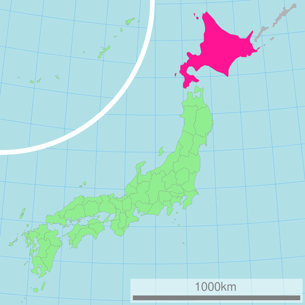
This image was a edited version of File:Map of Japan with highlight on 01 Hokkaido prefecture.svg and File:Map of Japan with highlight on 01edit Hokkaido prefecture.svg due to the following reasons:
Using of Hokkaido map where Kuril Islands belong to Japan its violation of principle "neutral point of view", abuse of independence, contravention of law and can not be placed in encyclopedia article. In this article must be placed map without Kuril Islands.
This edited version contain the en:Kuril Islands dispute shaded in Gray
| 概要 Description |
日本全図 北海道の位置図 Map of Japan with highlight on Hokkaido
| |||||
| 作成者 Author |
Lincun | |||||
| 使用データ Source |
国土交通省 国土数値情報(行政区域) | |||||
| Permission |
|

Original upload log
| date/time | username | resolution | size | edit summary |
|---|---|---|---|---|
| 11:36, 3 March 2007 | User:Lincun | 1,024×1,024 | 15 KB |
Image description page history
| link | date/time | username | edit summary |
|---|---|---|---|
| [1] | 13:02, 7 September 2007 | User:LERK | |
| [2] | 11:51, 17 July 2007 | User:BilabialBoxing | |
| [3] | 11:36, 3 March 2007 | User:Lincun | ({{都道府県地図情報 |都道府県=北海道 |都道府県Latin=Hokkaido }}) |
![[1]](https://commons.wikimedia.org/w/index.php?title=Image:Map_of_Japan_with_highlight_on_01_Hokkaido_北海道.svg&redirect=no&oldid=7415936)
![[2]](https://commons.wikimedia.org/w/index.php?title=Image:Map_of_Japan_with_highlight_on_01_Hokkaido_北海道.svg&redirect=no&oldid=6614205)
![[3]](https://commons.wikimedia.org/w/index.php?title=Image:Map_of_Japan_with_highlight_on_01_Hokkaido_北海道.svg&redirect=no&oldid=4606209)
檔案歷史
撳個日期/時間去睇響嗰個時間出現過嘅檔案。
| 日期/時間 | 縮圖 | 尺寸 | 用戶 | 註解 | |
|---|---|---|---|---|---|
| 現時 | 2009年1月24號 (六) 22:40 | | 1,024 × 1,024(90 KB) | ASDFGHJ | {{Information |Description= |Source= |Date= |Author= |Permission= |other_versions= }} |
| 2009年1月24號 (六) 22:01 |  | 1,024 × 1,024(30 KB) | ASDFGHJ | This image was a edited version of Image:Map of Japan with highlight on 01 Hokkaido prefecture.svg and Image:ap of Japan with highlight on 01edit Hokkaido prefecture.svg due to the following reasons: Using of Hokkaido map where Kuril Islands be |
檔案用途
以下嘅1版用到呢個檔:
全域檔案使用情況
下面嘅維基都用緊呢個檔案:
- ace.wikipedia.org嘅使用情況
- ang.wikipedia.org嘅使用情況
- az.wikipedia.org嘅使用情況
- be.wikipedia.org嘅使用情況
- bn.wikipedia.org嘅使用情況
- bo.wikipedia.org嘅使用情況
- cdo.wikipedia.org嘅使用情況
- ceb.wikipedia.org嘅使用情況
- de.wikipedia.org嘅使用情況
- en.wikipedia.org嘅使用情況
- eu.wikipedia.org嘅使用情況
- fo.wikipedia.org嘅使用情況
- gd.wikipedia.org嘅使用情況
- hak.wikipedia.org嘅使用情況
- hr.wikipedia.org嘅使用情況
- hu.wikipedia.org嘅使用情況
- id.wikipedia.org嘅使用情況
- ilo.wikipedia.org嘅使用情況
- incubator.wikimedia.org嘅使用情況
- is.wikipedia.org嘅使用情況
- km.wikipedia.org嘅使用情況
- ko.wikipedia.org嘅使用情況
- lt.wikipedia.org嘅使用情況
- mr.wikipedia.org嘅使用情況
- ms.wikipedia.org嘅使用情況
- my.wikipedia.org嘅使用情況
- nov.wikipedia.org嘅使用情況
- or.wikipedia.org嘅使用情況
- pa.wikipedia.org嘅使用情況
- pl.wikipedia.org嘅使用情況
- pl.wiktionary.org嘅使用情況
- pnb.wikipedia.org嘅使用情況
- pt.wikipedia.org嘅使用情況
- rm.wikipedia.org嘅使用情況
- ru.wikipedia.org嘅使用情況
- simple.wikipedia.org嘅使用情況
- si.wikipedia.org嘅使用情況
- sq.wikipedia.org嘅使用情況
- th.wikipedia.org嘅使用情況
- tl.wikipedia.org嘅使用情況
睇呢個檔案嘅更多全域使用情況。