File:Okhotsk Subprefecture.png

預覽大細:800 × 506 像素。 第啲解像度:320 × 202 像素|640 × 405 像素|1,150 × 727 像素。
原本檔案 (1,150 × 727 像素,檔案大細:71 KB ,MIME類型:image/png)
摘要
| 描述 |
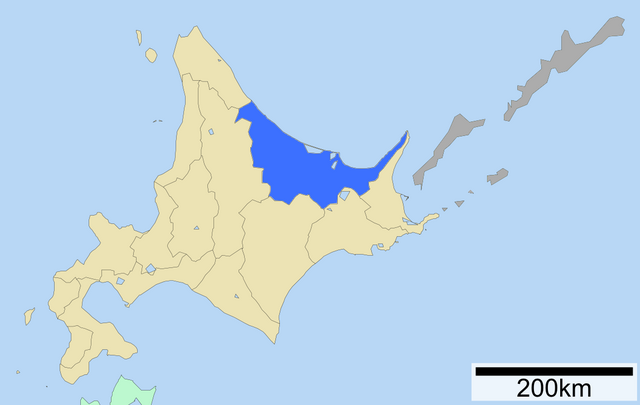
English: Map of Abashiri Subprefecture |
| 日期 | |
| 來源 | |
| 作者 |
|
協議

|
根據自由軟體基金會發佈嘅無固定段落、封面文字同封底文字GNU自由文件授權條款第1.2或打後嘅版本,你獲授權可以重製、散佈同埋修改爾份文件。授權條款嘅副本喺章節GNU自由文件授權條款。 |
| 呢個檔案用共享創意 姓名標示-非商業性-相同方式分享3.0 未本地化版本條款授權。 | ||
| 姓名標示: ASDFGH at 英文 維基百科 | ||
| ||
| This licensing tag was added to this file as part of the GFDL licensing update. |
Original upload log
Transferred from en.wikipedia to Commons by Sreejithk2000 using CommonsHelper.
The original description page was here. All following user names refer to en.wikipedia.
- 2009-11-18 04:58 ASDFGH 1150×727× (73050 bytes) {{Information |Description=Map of Abashiri Subprefecture |Source=*[[:ja:ファイル:日本地域区画地図補助 01420.svg|日本地域区画地図補助 01420.svg]] |Date=17 November 2009 |Author=*derivative work: [[User:ASDFGH|ASDFGH]] ([[User talk:A
檔案歷史
撳個日期/時間去睇響嗰個時間出現過嘅檔案。
| 日期/時間 | 縮圖 | 尺寸 | 用戶 | 註解 | |
|---|---|---|---|---|---|
| 現時 | 2010年5月29號 (六) 05:08 | | 1,150 × 727(71 KB) | File Upload Bot (Magnus Manske) | {{BotMoveToCommons|en.wikipedia|year={{subst:CURRENTYEAR}}|month={{subst:CURRENTMONTHNAME}}|day={{subst:CURRENTDAY}}}} {{Information |Description={{en|Map of Abashiri Subprefecture<br/> en:Category:Subprefectures in Hokkaidō}} |Source=Transferred |
檔案用途
以下嘅1版用到呢個檔:
全域檔案使用情況
下面嘅維基都用緊呢個檔案:
- ca.wikipedia.org嘅使用情況
- de.wikipedia.org嘅使用情況
- en.wikipedia.org嘅使用情況
- es.wikipedia.org嘅使用情況
- eu.wikipedia.org嘅使用情況
- fi.wikipedia.org嘅使用情況
- fr.wikipedia.org嘅使用情況
- gl.wikipedia.org嘅使用情況
- id.wikipedia.org嘅使用情況
- ilo.wikipedia.org嘅使用情況
- ka.wikipedia.org嘅使用情況
- lt.wikipedia.org嘅使用情況
- pl.wikipedia.org嘅使用情況
- ru.wikipedia.org嘅使用情況
- sv.wikipedia.org嘅使用情況
- tg.wikipedia.org嘅使用情況
- th.wikipedia.org嘅使用情況
- tr.wikipedia.org嘅使用情況
- vi.wikipedia.org嘅使用情況
- www.wikidata.org嘅使用情況