File:Rozenhoedkaai Brugge.jpg

原本檔案 (4,202 × 2,549 像素,檔案大細:4.04 MB ,MIME類型:image/jpeg)
| Camera location | | View this and other nearby images on: OpenStreetMap |
|---|
| 描述 |
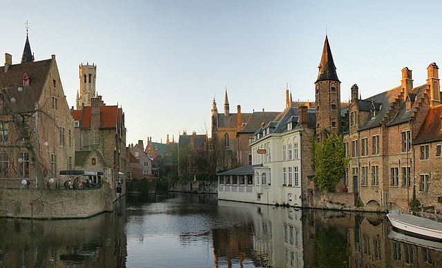
English: View from the Rozenhoedkaai in Brugge, Belgium |
| 日期 | |
| 來源 | 自己作品 |
| 作者 | Hans Hillewaert |
| 許可 (重用呢個檔案) |
我,呢份作品嘅作者,決定用以下許可發佈呢件作品: 呢個檔案用共享創意 姓名標示-非商業性-相同方式分享3.0 未本地化版本條款授權。
|
| Other licenses | More (4100+) and new images on : High resolution files on request. . |
| 姓名標示 (required by the license) | © Hans Hillewaert / |
檔案歷史
撳個日期/時間去睇響嗰個時間出現過嘅檔案。
| 日期/時間 | 縮圖 | 尺寸 | 用戶 | 註解 | |
|---|---|---|---|---|---|
| 現時 | 2010年6月22號 (二) 07:26 | | 4,202 × 2,549(4.04 MB) | Lycaon | {{location|51|12|26.33|N|3|13|39.51|E|region:BE_heading:WNW}} {{Information |Description= {{en|View from the Rozenhoedkaai in Brugge, Belgium}} |Source= {{own}} |Date= 2008-12-26 |Author= Hans Hillewaert |Permission= {{self|cc-by-sa-3.0} |
檔案用途
以下嘅1版用到呢個檔:
全域檔案使用情況
下面嘅維基都用緊呢個檔案:
- af.wikipedia.org嘅使用情況
- bn.wikipedia.org嘅使用情況
- br.wikipedia.org嘅使用情況
- bs.wikipedia.org嘅使用情況
- ceb.wikipedia.org嘅使用情況
- cs.wikipedia.org嘅使用情況
- en.wikipedia.org嘅使用情況
- es.wikipedia.org嘅使用情況
- et.wikipedia.org嘅使用情況
- fi.wikipedia.org嘅使用情況
- fy.wikipedia.org嘅使用情況
- ja.wikipedia.org嘅使用情況
- la.wikipedia.org嘅使用情況
- pt.wikipedia.org嘅使用情況
- sl.wikipedia.org嘅使用情況
- sw.wikipedia.org嘅使用情況
- te.wikipedia.org嘅使用情況
- tr.wikipedia.org嘅使用情況
- ur.wikipedia.org嘅使用情況
- www.wikidata.org嘅使用情況