File:Satsunan Islands.png

預覽大細:432 × 600 像素。 第啲解像度:173 × 240 像素|346 × 480 像素|780 × 1,083 像素。
原本檔案 (780 × 1,083 像素,檔案大細:76 KB ,MIME類型:image/png)

|
This locator map image could be recreated using vector graphics as an SVG file. This has several advantages; see Commons:Media for cleanup for more information. If an SVG form of this image is already available, please upload it. After uploading an SVG, replace this template with {{vector version available|new image name.svg}}.
|
摘要
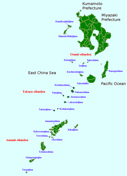
| 描述 | Map of the Satsunan Islands (Ōsumi Islands + Tokara Islands + Amami Islands), Ryukyu , Japan |
| 日期 | (UTC) |
| 來源 | 自己作品 |
| 作者 | Krisgrotius |
| Other versions |
Derivative works of this file: |
協議
| I, the copyright holder of this work, release this work into the public domain. This applies worldwide. In some countries this may not be legally possible; if so: I grant anyone the right to use this work for any purpose, without any conditions, unless such conditions are required by law. |
檔案歷史
撳個日期/時間去睇響嗰個時間出現過嘅檔案。
| 日期/時間 | 縮圖 | 尺寸 | 用戶 | 註解 | |
|---|---|---|---|---|---|
| 現時 | 2007年1月5號 (五) 16:16 | | 780 × 1,083(76 KB) | Krisgrotius | {{Information |Description=Map of the Satsunan Islands (Ōsumi Islands + Tokara Islands + Amami Islands), Ryukyu , Japan |Source= own work |Date=~~~~~ |Author=~~~ |Permission= |other_versions= public }} |
檔案用途
無嘢連來呢份檔案。
全域檔案使用情況
下面嘅維基都用緊呢個檔案:
- cy.wikipedia.org嘅使用情況
- fa.wikipedia.org嘅使用情況
- nl.wikipedia.org嘅使用情況