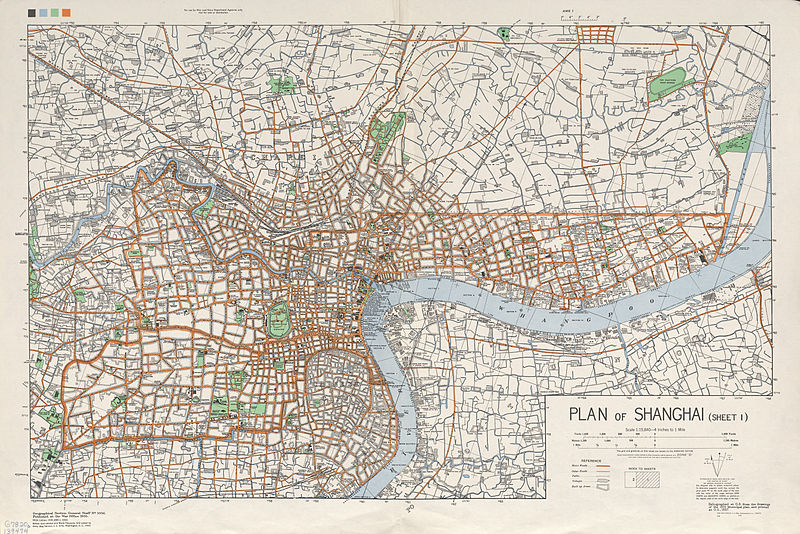
File:Shanghai 1935 S1 AMS-WO.jpg

原本檔案 (6,261 × 4,180 像素,檔案大細:9.96 MB ,MIME類型:image/jpeg

摘要

Description
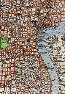
English: Map of central Shanghai. Printed by the British War Office / US Army Map Service.
日期
來源 University of Texas Perry-Castañeda Library Map Collection
https://maps.lib.utexas.edu/maps/historical/history_china.html
https://maps.lib.utexas.edu/maps/ams/china_city_plans/txu-oclc-6567312-1.jpg
Creator
United States Army Map Service
 Geotemporal data
Bounding box
N: 31.3236751°N
W: 121.3885856°E E: 121.5923357°E
S: 31.1760209°N
Georeferencing View the georeferenced map in the Wikimaps Warper
Other versions

維基百科

 This is a featured picture on the English language Wikipedia (Featured pictures) and is considered one of the finest images. See its nomination here.

If you think this file should be featured on Wikimedia Commons as well, feel free to nominate it.
If you have an image of similar quality that can be published under a suitable copyright license, be sure to upload it, tag it, and nominate it.

協議

Public domain
This file is a work of a U.S. Army soldier or employee, taken or made as part of that person's official duties. As a work of the U.S. federal government, it is in the public domain in the United States.

العربية  বাংলা  català  čeština  Deutsch  English  español  eesti  فارسی  suomi  français  hrvatski  magyar  Bahasa Indonesia  italiano  日本語  한국어  lietuvių  македонски  മലയാളം  မြန်မာဘာသာ  Nederlands  polski  português  русский  sicilianu  српски / srpski  Türkçe  українська  Tiếng Việt  中文(简体)  中文(繁體)  +/−

Captions

Add a one-line explanation of what this file represents

Items portrayed in this file

圖中顯示嘅係

檔案歷史

撳個日期/時間去睇響嗰個時間出現過嘅檔案。

日期/時間縮圖尺寸用戶註解
現時2012年2月27號 (一) 23:46響2012年2月27號 (一) 23:46嘅縮圖版本6,261 × 4,180(9.96 MB)Rosemania

以下嘅1版用到呢個檔:

全域檔案使用情況

Metadata