File:Strait tiran 83.jpg
預覽大細:472 × 599 像素。 第啲解像度:189 × 240 像素|378 × 480 像素|996 × 1,264 像素。
原本檔案 (996 × 1,264 像素,檔案大細:198 KB ,MIME類型:image/jpeg)
| 描述 |
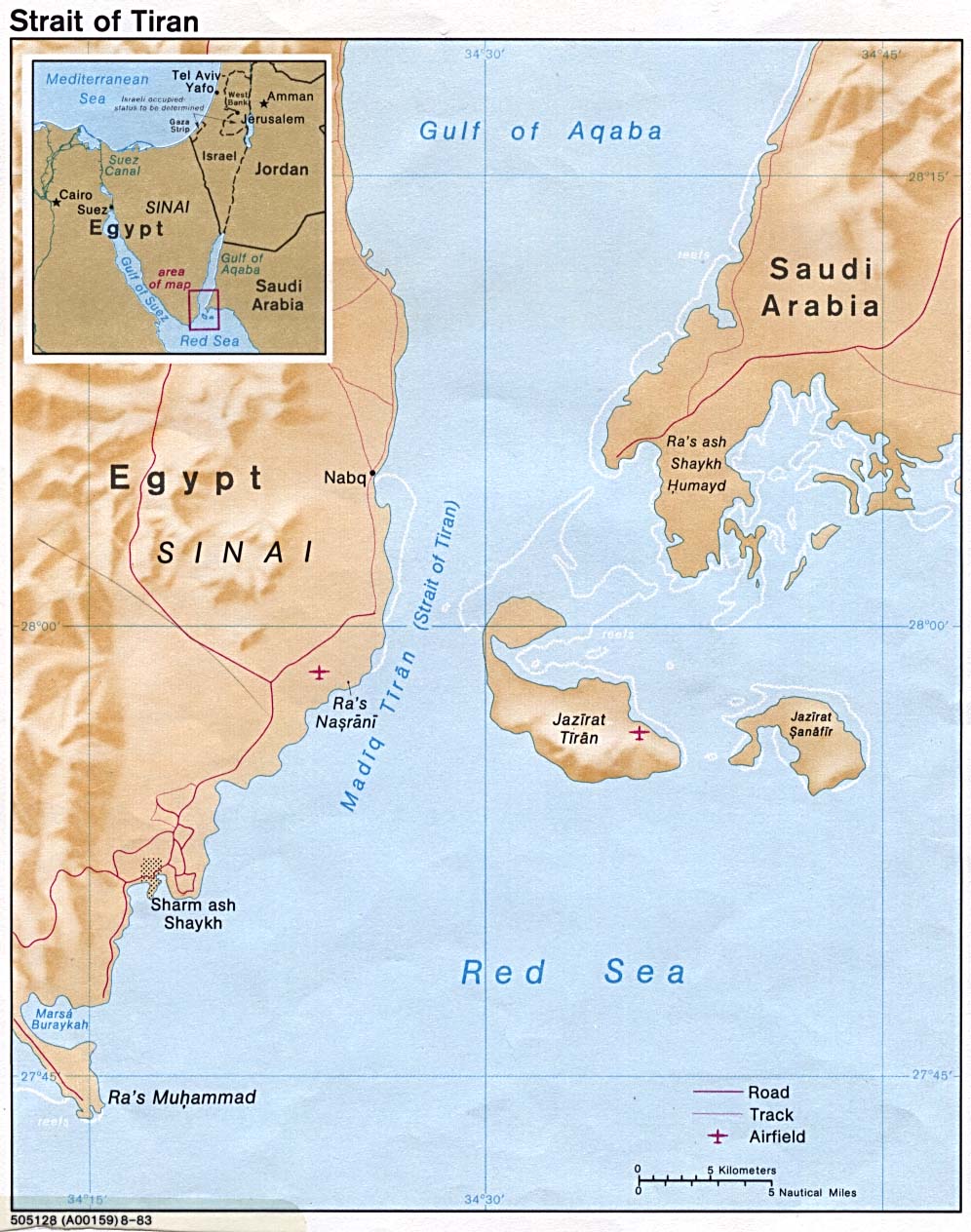
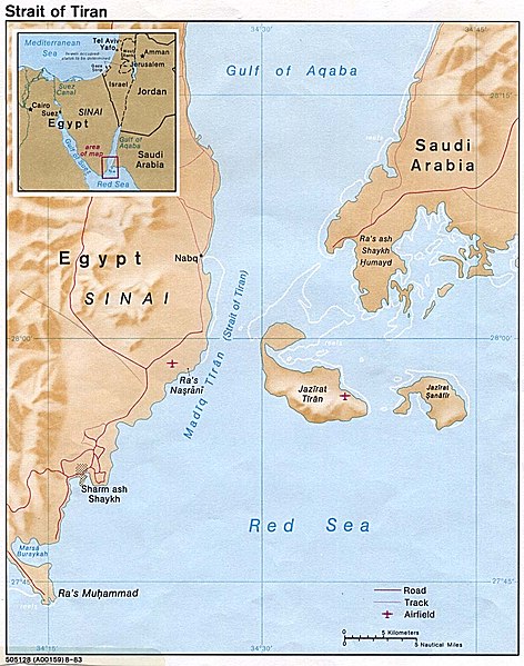
English: Strait of Tiran between Gulf of Aqaba and Red Sea |
|||
| 日期 | ||||
| 來源 | http://www.lib.utexas.edu/maps/middle_east_and_asia/strait_tiran_83.jpg | |||
| 作者 | "The following maps were produced by the U.S. Central Intelligence Agency, unless otherwise indicated." | |||
| 許可 (重用呢個檔案) |
|
|||
| Other versions | العربيَّة |

檔案歷史
撳個日期/時間去睇響嗰個時間出現過嘅檔案。
| 日期/時間 | 縮圖 | 尺寸 | 用戶 | 註解 | |
|---|---|---|---|---|---|
| 現時 | 2007年2月23號 (五) 16:46 | | 996 × 1,264(198 KB) | Monack | {{Information |Description = {{en|Strait of Tiran between Gulf of Aqaba and Red Sea}} |Source = http://www.lib.utexas.edu/maps/middle_east_and_asia/strait_tiran_83.jpg |Date = 1983 |Author = "The following maps were produced by the U.S. Central Intellige |
檔案用途
以下嘅1版用到呢個檔:
全域檔案使用情況
下面嘅維基都用緊呢個檔案:
- af.wikipedia.org嘅使用情況
- als.wikipedia.org嘅使用情況
- ar.wikipedia.org嘅使用情況
- arz.wikipedia.org嘅使用情況
- az.wikipedia.org嘅使用情況
- be.wikipedia.org嘅使用情況
- bg.wikipedia.org嘅使用情況
- bn.wikipedia.org嘅使用情況
- ca.wikipedia.org嘅使用情況
- cs.wikipedia.org嘅使用情況
- da.wikipedia.org嘅使用情況
- de.wikipedia.org嘅使用情況
- el.wikipedia.org嘅使用情況
- en.wikipedia.org嘅使用情況
- en.wikivoyage.org嘅使用情況
- es.wikipedia.org嘅使用情況
- eu.wikipedia.org嘅使用情況
- fa.wikipedia.org嘅使用情況
- fi.wikipedia.org嘅使用情況
- fr.wikipedia.org嘅使用情況
- he.wikipedia.org嘅使用情況
- hy.wikipedia.org嘅使用情況
- id.wikipedia.org嘅使用情況
- it.wikipedia.org嘅使用情況
睇呢個檔案嘅更多全域使用情況。