File:Turkish Strait disambig.svg

呢個「SVG」檔案嘅呢個「PNG」預覽嘅大細:469 × 388 像素。 第啲解像度:290 × 240 像素|580 × 480 像素|928 × 768 像素|1,238 × 1,024 像素|2,476 × 2,048 像素。
原本檔案 (SVG檔案,表面大細: 469 × 388 像素,檔案大細:90 KB)
摘要
| 描述 |
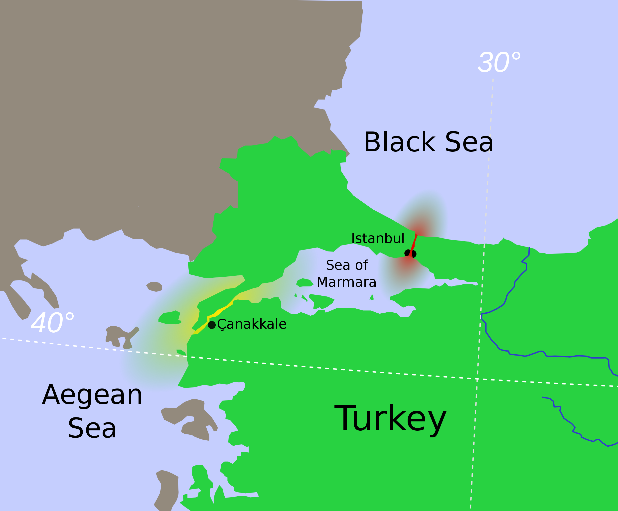
Hrvatski: Tjesnaci Bospor i Dardaneli Türkçe: Türk Boğazlarının harita üzerinde renkledirme ile açıklaması
Ελληνικά: τα Στενά του Βοσπόρου Українська: Турецькі протоки.
Босфор
Дарданелли मराठी: तुर्कस्तानमधील बोस्फोरस व डार्डेनेल्झ ह्या सामुद्रधुन्या 日本語: 海峡地帯(トルコ) |
||
| 日期 | |||
| 來源 | Modified from File:Vertrag sevres otoman.svg, created by Thomas Steiner. | ||
| 作者 | User:Interiot | ||
| Other versions |
[]
|
||
| SVG genesis |


.svg)


協議
This file is licensed under the Creative Commons Attribution-Share Alike 2.5 Generic license.
- 你可以:
- 去分享 – 複製、發佈同傳播呢個作品
- 再改 – 創作演繹作品
- 要遵照下面嘅條件:
- 署名 – 你一定要畀合適嘅表彰、畀返指向呢個授權條款嘅連結,同埋寫明有無改過嚟。你可以用任何合理方式去做,但唔可以用任何方式暗示授權人認可咗你或者你嘅使用方式。
- 相同方式分享 – 如果你用任何方式改過呢個作品,你必須要用返原本或者相似嘅條款發佈。
Original upload log
The original description page was here. All following user names refer to en.wikipedia.
- 2007-01-16 22:04 Interiot 469×388× (94044 bytes) oops
- 2007-01-16 20:59 Interiot 469×388× (122640 bytes) actually, make it clear that Istanbul straddles the strait
- 2007-01-16 20:47 Interiot 469×388× (90212 bytes) Disambiguation for [[Turkish Straights]]. Modified from [[:Image:Vertrag sevres otoman.svg]], created by [[:de:Benutzer:Thire|Thomas Steiner]]. {{cc-by-sa-2.5}}
檔案歷史
撳個日期/時間去睇響嗰個時間出現過嘅檔案。
| 日期/時間 | 縮圖 | 尺寸 | 用戶 | 註解 | |
|---|---|---|---|---|---|
| 現時 | 2012年1月26號 (四) 06:21 | | 469 × 388(90 KB) | OgreBot | (BOT): Reverting to most recent version before archival |
| 2012年1月26號 (四) 06:21 |  | 469 × 388(92 KB) | OgreBot | (BOT): Uploading old version of file from en.wikipedia; originally uploaded on 2007-01-16 22:04:20 by Interiot | |
| 2012年1月26號 (四) 06:21 |  | 469 × 388(120 KB) | OgreBot | (BOT): Uploading old version of file from en.wikipedia; originally uploaded on 2007-01-16 20:59:55 by Interiot | |
| 2012年1月26號 (四) 06:21 |  | 469 × 388(88 KB) | OgreBot | (BOT): Uploading old version of file from en.wikipedia; originally uploaded on 2007-01-16 20:47:38 by Interiot | |
| 2008年12月19號 (五) 16:16 |  | 469 × 388(90 KB) | RafaAzevedo | {{Information |Description={{en|1=Disambiguation for Turkish Straits. {{legend|#eb0000|Bosporus Strait}} {{legend|#ffe605|Dardanelles Strait}} == License == Modified from Image:Vertrag sevres otoman.svg, created by |
檔案用途
全域檔案使用情況
下面嘅維基都用緊呢個檔案:
- af.wikipedia.org嘅使用情況
- ar.wikipedia.org嘅使用情況
- azb.wikipedia.org嘅使用情況
- az.wikipedia.org嘅使用情況
- bg.wikipedia.org嘅使用情況
- bn.wikipedia.org嘅使用情況
- bs.wikipedia.org嘅使用情況
- ca.wikipedia.org嘅使用情況
- da.wikipedia.org嘅使用情況
- el.wikipedia.org嘅使用情況
- en.wikipedia.org嘅使用情況
- Bosporus
- Dardanelles
- Montreux Convention Regarding the Regime of the Straits
- Sea of Marmara
- Dardanus (son of Zeus)
- Truman Doctrine
- Gallipoli campaign
- Landing at Cape Helles
- Naval operations in the Dardanelles campaign
- London Straits Convention
- Treaty of Hünkâr İskelesi
- Chanak Crisis
- Turkish straits
- Constantinople Agreement
- Turkish straits crisis
- User:Chickstarr404/Gather lists/13386 – "A Travelers Alphabet" by Stephen Runciman
- International Straits Commission
- User:Abyssal/bla
- en.wiktionary.org嘅使用情況
睇呢個檔案嘅更多全域使用情況。