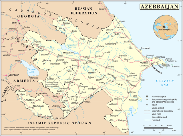
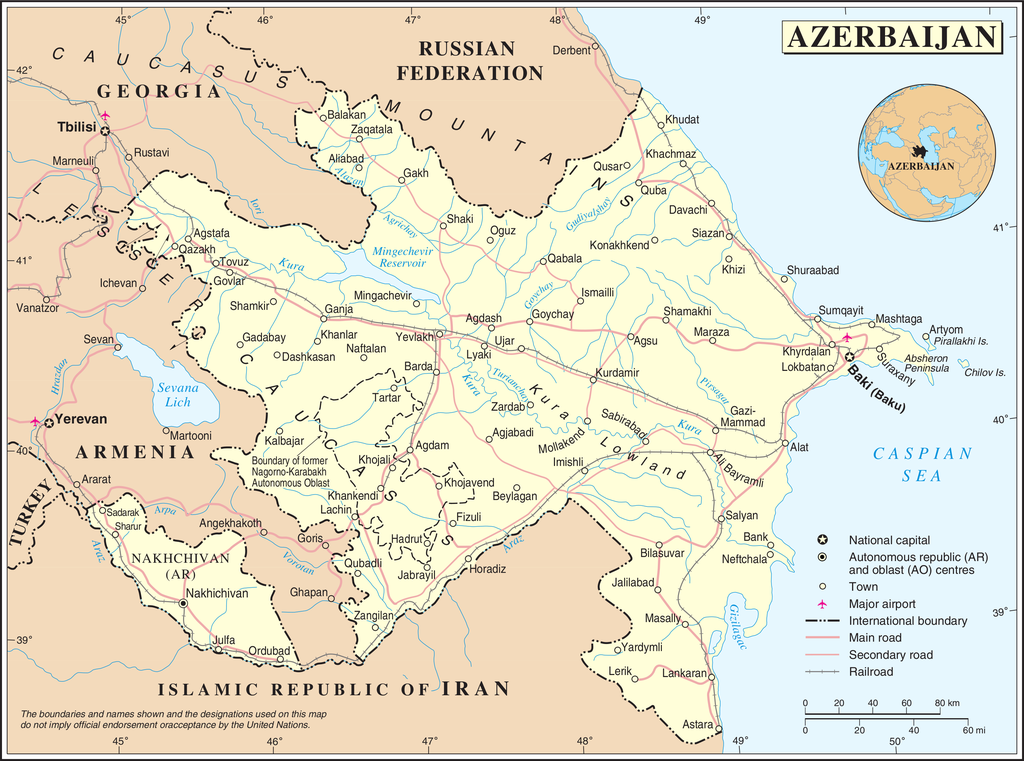
File:Un-azerbaijan.png

原本檔案 (3,037 × 2,257 像素,檔案大細:1.56 MB ,MIME類型:image/png)
| This image is a map derived from a United Nations map.
Unless stated otherwise, UN maps are to be considered in the public domain. This applies worldwide. UN maps are, in principle, open source material and you can use them in your work or for making your own map. UN requests however that you delete the UN name, logo and reference number upon any modification to the map. Content of your map will be your responsibility. You can state in your publication, if you wish, something like: based on UN map … (map name, map number, revision number and date). See: Geospatial Information Section. And: Geospatial, location data for a better world. |
 |
檔案歷史
撳個日期/時間去睇響嗰個時間出現過嘅檔案。
| 日期/時間 | 縮圖 | 尺寸 | 用戶 | 註解 | |
|---|---|---|---|---|---|
| 現時 | 2007年10月23號 (二) 02:50 | | 3,037 × 2,257(1.56 MB) | Jeroen | {{UN map}} Category:Maps of Azerbaijan |
檔案用途
以下嘅1版用到呢個檔:
全域檔案使用情況
下面嘅維基都用緊呢個檔案:
- af.wikipedia.org嘅使用情況
- bn.wikipedia.org嘅使用情況
- ce.wikipedia.org嘅使用情況
- da.wikipedia.org嘅使用情況
- de.wikipedia.org嘅使用情況
- en.wikipedia.org嘅使用情況
- fi.wikipedia.org嘅使用情況
- fr.wikipedia.org嘅使用情況
- gag.wikipedia.org嘅使用情況
- gom.wikipedia.org嘅使用情況
- he.wikipedia.org嘅使用情況
- ka.wikipedia.org嘅使用情況
- mzn.wikipedia.org嘅使用情況
- nds.wikipedia.org嘅使用情況
- nn.wikipedia.org嘅使用情況
- no.wikipedia.org嘅使用情況
- pcd.wikipedia.org嘅使用情況
- pl.wiktionary.org嘅使用情況
睇呢個檔案嘅更多全域使用情況。