File:United States (orthographic projection).svg

呢個「SVG」檔案嘅呢個「PNG」預覽嘅大細:541 × 541 像素。 第啲解像度:240 × 240 像素|480 × 480 像素|768 × 768 像素|1,024 × 1,024 像素|2,048 × 2,048 像素。
原本檔案 (SVG檔案,表面大細: 541 × 541 像素,檔案大細:396 KB)
摘要
| 描述 |
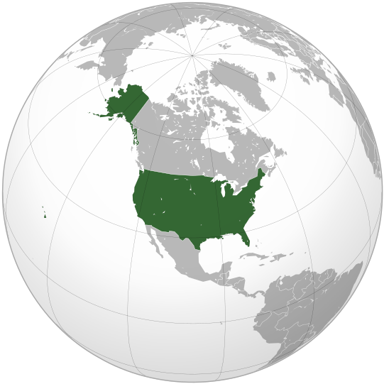
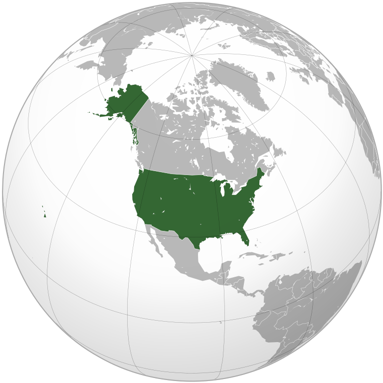
English: The United States
Esperanto: Loko de Usono sur la terglobo |
||||
| 日期 | |||||
| 來源 |
Own work, This W3C-unspecified vector image was created with Inkscape . Aquarius.geomar.de
|
||||
| 作者 | Ssolbergj |

.svg?uselang=yue)
協議
我,呢份作品嘅作者,決定用以下許可發佈呢件作品:
Ĉi tiu dosiero estas disponebla laŭ la permesilo Krea Komunaĵo Atribuite 3.0 Neadaptita.
- 你可以:
- 去分享 – 複製、發佈同傳播呢個作品
- 再改 – 創作演繹作品
- 要遵照下面嘅條件:
- 署名 – 你一定要畀合適嘅表彰、畀返指向呢個授權條款嘅連結,同埋寫明有無改過嚟。你可以用任何合理方式去做,但唔可以用任何方式暗示授權人認可咗你或者你嘅使用方式。
檔案歷史
撳個日期/時間去睇響嗰個時間出現過嘅檔案。
| 日期/時間 | 縮圖 | 尺寸 | 用戶 | 註解 | |
|---|---|---|---|---|---|
| 現時 | 2009年10月2號 (五) 00:36 | | 541 × 541(396 KB) | Raeky | try again |
| 2009年10月2號 (五) 00:33 |  | 541 × 541(395 KB) | Raeky | seems I broke something, hmm | |
| 2009年10月2號 (五) 00:33 |  | 541 × 541(113 KB) | Raeky | making Manitoulin Island gray colored, part of Canada | |
| 2008年10月21號 (二) 22:40 |  | 541 × 541(395 KB) | Ssolbergj | {{Information |Description= |Source= |Date= |Author= |Permission= |other_versions= }} | |
| 2008年10月20號 (一) 23:59 |  | 541 × 541(717 KB) | Ssolbergj | {{Information |Description={{en|1=The United States}} |Source=Own work, {{Inkscape}}<br />[http://www.aquarius.geomar.de/omc/make_map.html Aquarius.geomar.de]<br />{{GFDL-GMT}} |Author=Ssolbergj |Date=21 October 2008 |Permission= |other |
檔案用途
以下嘅1版用到呢個檔:
全域檔案使用情況
下面嘅維基都用緊呢個檔案:
- ady.wikipedia.org嘅使用情況
- af.wikipedia.org嘅使用情況
- ar.wikipedia.org嘅使用情況
- ar.wikinews.org嘅使用情況
- ar.wiktionary.org嘅使用情況
- av.wikipedia.org嘅使用情況
- azb.wikipedia.org嘅使用情況
- az.wiktionary.org嘅使用情況
- ban.wikipedia.org嘅使用情況
- ba.wikipedia.org嘅使用情況
- be-tarask.wikipedia.org嘅使用情況
- be.wikipedia.org嘅使用情況
- bjn.wikipedia.org嘅使用情況
- bs.wikipedia.org嘅使用情況
- cbk-zam.wikipedia.org嘅使用情況
- ch.wikipedia.org嘅使用情況
- ckb.wikipedia.org嘅使用情況
- cs.wikipedia.org嘅使用情況
- cu.wikipedia.org嘅使用情況
- de.wikipedia.org嘅使用情況
- de.wiktionary.org嘅使用情況
- dsb.wikipedia.org嘅使用情況
- dty.wikipedia.org嘅使用情況
- el.wikipedia.org嘅使用情況
- en.wikipedia.org嘅使用情況
- Nuclear weapons of the United States
- Wikipedia:Userboxes/Music/Artists
- List of sovereign states and dependent territories in North America
- Outline of the United States
- Fishing industry in the United States
- Talk:European Union/Archive 22
- User:Deluca.michael1996
- User:ZenCopain/1976 (United States)
- Wikipedia:Graphics Lab/Illustration workshop/Archive/Oct 2009
- User:Spacestoned/Artifact-03
- User:Feroang/sandbox
- User:Thepaulba
- User:Aria1561
- User:NiklawskiMSTM/Userboxes
- Talk:United States/Archive 64
- Talk:United States/Archive 81
- User:Always forever
- Talk:European Union/Archive 30
- User:Jogosoccer
- Africa–United States relations
睇呢個檔案嘅更多全域使用情況。
.svg)
.svg)